
What is recorded here
In close proximity to a flat cemetery (DG039-012----) which was uncovered in the 1950s (Lacy et al. 1983, 65). In 1998 local archaeological field–walkers identified a pit burial in a quarry face from which they gathered quantities of bones and some pottery. The area was investigated the following year by Halpin on…
Read the whole record
From the National Monuments Service (Archaeological Survey of Ireland) record DG039-016
Places near here
Photo credits
- Maker not stated on source page, www.flickr.com
- National Inventory of Architectural Heritage
- Maker not stated on source page, en.advisor.travel
- Picture: Wild Ireland
- Maker not stated on source page, en.wikipedia.org
- stuart r hines, Geograph · CC BY-SA 2.0
- Alistair Cunningham, Wikimedia Commons · CC BY 3.0
- Greg Clarke, Wikimedia Commons · CC BY 2.0
- Maker not stated on source page, internationalexcellence.co.uk
- Maker not stated on source page, commons.wikimedia.org
 Drumhaggart Flat CemeteryFlat cemetery · 28 yd
Explorer Tom Drumhaggart Flat Cemetery came to light in 1950 when six cists containing cremated remains were found. One held a small…
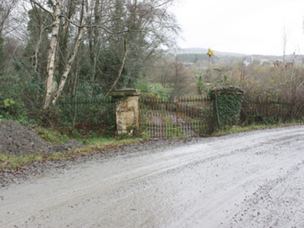 Birdstown HouseDemesne walls/gates/railings · 556 yd
Explorer Tom Birdstown House's gateway was built around 1820; the house itself is gone, but the gate still makes an entrance. An…
 Cist in Birdstown DemesneCist · 1117 yd
Explorer Tom Cist in Birdstown Demesne comes from a local report of a burial box found in a working sandpit. The record has no…
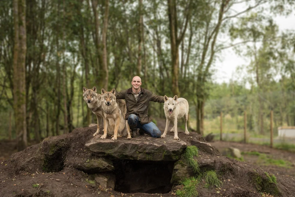 Wild IrelandWildlife sanctuary and family attraction · 1741 yd
Explorer Tom Wild Ireland near Burnfoot gives you the rare Donegal dilemma of looking for bears and finding yourself just as…
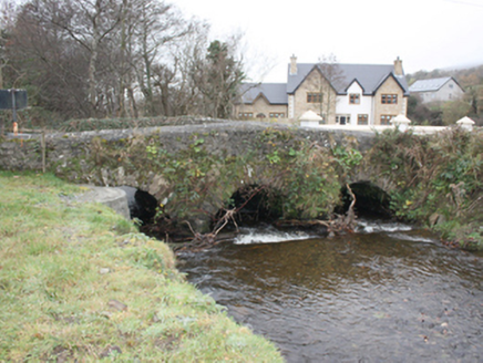 Glen BridgeBridge · 1.1 mi
Explorer Tom Glen Bridge in Ballyederowen claims its name actually means 'Glen where the cows get confused,' which is honestly very…
 bridge1.1 mi
Explorer Tom Bridge in Drumadooey was built c. 1800 with one of its two round-headed arches currently blocked by vegetation. I bet…
 Standing stone in DerryvaneStanding stone · 1.4 mi
Explorer Tom Standing stone in Derryvane is currently hiding in plain sight, with no visible remains left on the sloping pasture. It…
 Castle & Earthwork Enclosure: Doherty Tower or Castle Aileach in Elagh MoreCastle & Earthwork Enclosure: Doherty Tower or Castle Aileach · 1.8 mi
Explorer Tom Castle Aileach is an earthwork enclosure that thinks it’s way cooler than the other castles because it has 'Aileach' in…
 Scalp MountainMountain / peak · 1.9 mi
Explorer Tom Scalp Mountain in County Donegal is recorded as a peak that definitely keeps its hair on. I imagine it’s got a bit of a…
 Muff ForestWoodland walk · 2.1 mi
Explorer Tom Lisnagra Woods near Muff is part of a walk with a name that sounds like the opening of a Donegal legend: Grania's Gap.…
 Frontier HotelHotel · 2.3 mi
Explorer Tom Frontier Hotel sits right at the edge of nowhere, making you feel important while you wait for dinner. Its family tree…
 Doherty's CafeCafé · 2.3 mi
Explorer Tom Doherty’s Café is where locals go when they can’t afford a hotel, serving coffee strong enough to wake the dead. Get me…
More archaeology and monuments in County Donegal · All of County Donegal

What do you know about this place?Tap to add a comment or ask a question