What is recorded here
An archaeological excavation by Kenneth Wiggins (00E0912) between 1December 2000 and January 2001 investigated the remains of five structures which turned out to be recent in date and of no archaeological significance.
From the National Monuments Service (Archaeological Survey of Ireland) record LI054-040001
The monument record does not grant public access. Check the route and ask the landowner before entering private land.
- What survives
- Recorded monument
Places near here
Photo credits
- National Inventory of Architectural Heritage
- Harold Strong, Geograph · CC BY-SA 2.0
- Mike Searle, Wikimedia Commons · CC BY-SA 2.0
- Mike Searle, Geograph · CC BY-SA 2.0
- Unknown author Unknown author, Wikimedia Commons · Public domain
- A.-K. D., Wikimedia Commons · CC BY-SA 4.0
 Allied Irish BankBank/financial institution · 47 yd
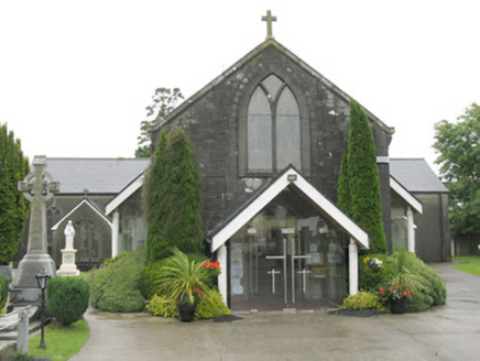 Saint Bartholomew's Catholic ChurchChurch/chapel · 174 yd
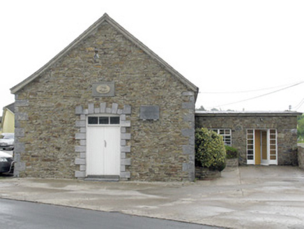 National Dairy Co-Operative MuseumCreamery · 208 yd
 National Co-op MuseumMuseum · 209 ydBurnt mound in Gardenfield SouthBurnt mound · 1515 ydEnclosure in BallinlongigEnclosure · 1.0 miToberacappeenSpring · 1.3 mi
 Castle (in Ruins)Castle, Anglo-Norman masonry castle · 2.6 mi
 Glenduff CastleCastle, tower house · 4.8 miMullaghareirk - Banane LoopWalking route · 6.3 mi
 Battle of LiscarrollMajor battlefield · 7.1 mi
 Saint Ite's WellSpring · 7.4 mi
More archaeology and monuments in County Limerick · All of County Limerick
What do you know about this place?