DDiscover AloneMapAbout

Doughbranneen

Cairn, burial cairn
Computer-made picture that does not show DoughbranneenNot a photo of this monument
Computer-made picture. It does not show this monument. · Report the wrong picture

The monument record does not grant public access. Check the route and ask the landowner before entering private land.

What do you know about this place?Tap to add a comment or ask a question

What you write will be public.

What is recorded here

Situated on bare karst pavement on the summit (OD 1041’) of Carnseefin Mountain, overlooking Galway Bay and with extensive views in all directions. Marked and named ‘Doughbranneen’ on the 1842 and 1915 eds. of the OS 6-inch maps and named ‘Dobhach Bhrainín’ on Robinson’s map (1977). Along with the Cairn named…

Read the whole record
Situated on bare karst pavement on the summit (OD 1041’) of Carnseefin Mountain, overlooking Galway Bay and with extensive views in all directions. Marked and named ‘Doughbranneen’ on the 1842 and 1915 eds. of the OS 6-inch maps and named ‘Dobhach Bhrainín’ on Robinson’s map (1977). Along with the Cairn named ‘Carnsefein’ (Carn Suí Finn) c. 470m NNE, on a lower OD (726’), the name suggests that it formed a focus for Fianna myths, which may have played an important role in medieval political discourse (Fitzpatrick and Hennessy 2017). Westropp (1901, 7) recorded it as nearly levelled but it remains an imposing structure. The cairn consists of two distinct elements, an earlier terraced and potentially multi-phased cairn, on top of which is a later smaller cairn. Both cairns have undergone restoration and consolidation works, the earlier cairn by Aegis Archaeology (Coyne and Lynch 2017a and b) and the later trigonometrical station by Earthstone (Curran 2017). The earlier cairn is roughly circular (18.3m E–W x 19.6m N–S; max H c. 2.5m) and built of limestone stones and slabs of varying sizes (Coyne and Lynch 2017a and b). Slippage of the cairn has likely enlarged the area it covers (original est. diam. c. 14m). Remnants of a possible kerb (stones max. dims. L 1.75m; H 0.4m; T 0.08m), potentially facing a revetment, are visible from W–S. Elsewhere the outer edge is covered by slippage. A series of internal revetments, that may have formed terraces, are also occasionally visible. From W, the outer kerb (av. H 0.4m) retains a flat terrace (Wth 0.8m). From there, a second revetment, a drystone wall (H 0.3m), rises to a second flat terrace (Wth 1.4m). Above this a third revetment, another drystone wall (H 0.35m), rises to retain the top of the cairn. Stone slippage gathered from the SW and E has been replaced on the cairn (Coyne and Lynch 2017b). The later cairn (H 1.55m; diam. at base 2.5m) is of drystone construction and centrally placed on top of the earlier cairn. In 2017 (Curran 2017), it underwent extensive conservation. The earlier cairn is likely a burial cairn of prehistoric date, originally of Neolithic or Bronze Age date. The various revetments likely represent a series of subsequent enlargements or ‘wrapping events’ (cf Richards 2013), added when encompassing new burials, as was the case at Poulawack cairn (CL009-032018-) (Hencken and Movius 1935; Brindley and Lanting 1992) and some cairns surrounding wedge tombs (Ó Maoldúin 2015). These may have provided terraces, as proposed by the conservation team (Coyne and Lynch 2017a and b), or may originally have been the full height of the monument, as is evident at Turlough Hill cairn (CL006-017002-) and for some internal revetments at Slievecarran cairn (CL006-022----) and as revealed by excavation in Poulawack (Hencken and Movius 1935). The smaller later cairn is likely a 19th-century trigonometrical station as indicated on the 1842 ed. map.

From the National Monuments Service (Archaeological Survey of Ireland) record CL002-001

Places near here

Photo credits
  • Maker not stated on source page, commons.wikimedia.org
  • Danny Burke, Wikimedia Commons · CC BY-SA 2.5
  • Maj Adev, Wikimedia Commons · CC BY-SA 2.0
  • Suzanne Mischyshyn, Geograph · CC BY-SA 2.0
  • Maker not stated on source page, www.galwaytourism.ie
  • Maker not stated on source page, www.tripadvisor.com
  • Maker not stated on source page, www.tripadvisor.ie
  • Gordon Hatton, Geograph · CC BY-SA 2.0
  • The original uploader was Rwxrwxrwx at English Wikipedia ., Wikimedia Commons · CC BY-SA 3.0
  • Maker not stated on source page, readymap.irish
  • Maker not stated on source page, www.pinterest.com
CairnCairn, unclassified · 480 yd

Explorer Tom Cairn in Aghaglinny North has no idea where it actually is, which is embarrassing for a mound of stones. It would cope…

CaherdoonfergusFairy fort / stone ringfort · 1252 yd

Explorer Tom Caherdoonfergus sits above Black Head like it owns the place, even if nobody knows who built it. Tell me if the fairy…

Black Head LighthouseLighthouse · 1.2 mi

Explorer Tom Black Head Lighthouse in Murrooghtoohy North was built in 1936 because someone forgot to install streetlights. A dance…

Black Head (Clare)Lighthouse · 1.2 mi

Explorer Tom The weather has such a long-standing grudge against Black Head Lighthouse that it brings all its best storms just to…

Black HeadHeadland · 1.2 mi

Explorer Tom Black Head would bring a very heavy coat to any party because it thinks it’s always cold and slightly damp inside. It’s…
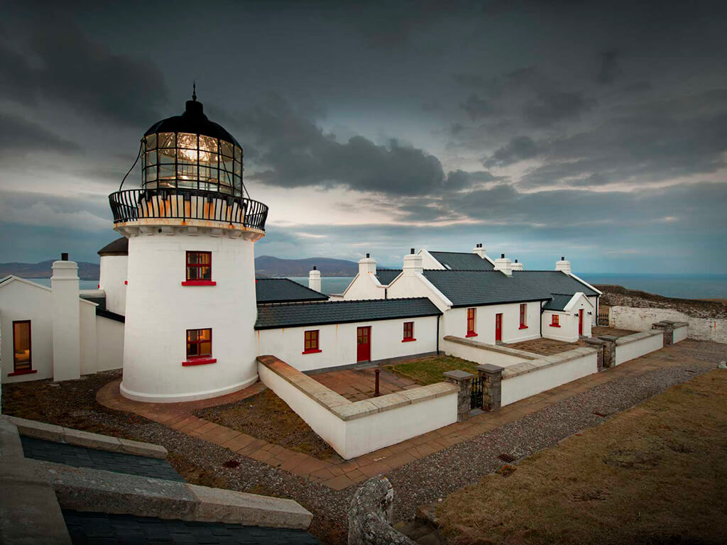
Lighthouse CaveCave · 1.3 mi

Explorer Tom Lighthouse Cave in Murrooghtoohy North has a prophecy about becoming the world's most famous cave, but it hasn't…

Caher Bridge GardenGarden · 1.4 mi

Explorer Tom Caher Bridge Garden has very strong opinions on modern buildings, particularly those that use glass, which it describes…

Fanore Beach - Burren GeositeVisitor information · 2.2 mi

Explorer Tom Fanore Beach - Burren Geosite is having a total identity crisis, posting selfies that are half sand and half ancient…

Fanore BeachBeach / strand · 2.2 mi

Explorer Tom Fanore Beach looks like somebody laid a bright sandy welcome mat at the edge of the Burren. The Caher River meets the…

AilladieCliff · 6.6 mi

Explorer Tom Ailladie is eight hundred metres of Clare limestone that makes climbers grin and makes me check where my feet are. The…

Mapped cemeteryCemetery · 18 mi

Explorer Tom I suspect this Mapped Cemetery in County Galway ended up in the wrong place because a very drunk surveyor misread his…

Graveyard in Tír An FhiaGraveyard · 18 mi

Explorer Tom Graveyard in Tír An Fhia had a fox take full charge of the headstones last winter, rearranging them for fun. It looks…

More archaeology and monuments in County Clare · All of County Clare

Add to this placeAdd a picture Add a detailed tip Add a story

Explore the map1,095,414 places to discover

Next place · or swipeCairn