
What is recorded here
From OpenStreetMap (© OpenStreetMap contributors) n8776554185
Places near here
Photo credits
- Richard Webb, Geograph · CC BY-SA 2.0
- National Inventory of Architectural Heritage
- Egbert Polski, Wikimedia Commons · CC BY-SA 4.0
- William England, Geograph · CC BY-SA 2.0
- Steve Edge, Wikimedia Commons · CC BY-SA 2.0
- Maker not stated on source page, www.dreamstime.com
- Enjoy Irish Culture; photographer not stated, Enjoy Irish Culture
- Britishfinance, Wikimedia Commons · CC BY-SA 4.0
- Maker not stated on source page, en.wikipedia.org
 Devilsmother Far North TopMountain / peak · 1.7 mi
Explorer Tom Devilsmother Far North Top thinks the road leading up to it is basically a personal insult to its dignity. It stands at…
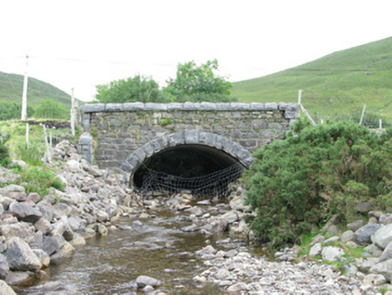 bridge1.8 mi
Explorer Tom Bridge in Munterowen East is showing off its rusticated limestone voussoirs like they’re high fashion. It’s a…
 Saint John the Baptist's Church (Aasleagh)Church/chapel · 1.9 mi
Explorer Tom Saint John the Baptist's Church in Srahatloe is worried about what the rabbits think of its architecture. They’ve been…
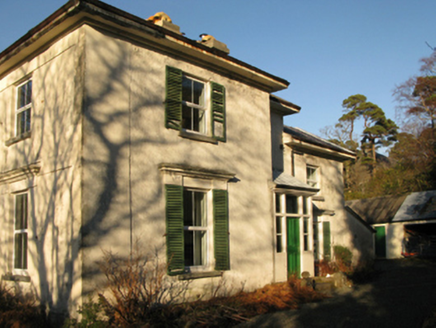 Aasleagh RectoryRectory/glebe/vicarage/curate's house · 1.9 mi
Explorer Tom Aasleagh Rectory is sitting on a hill overlooking Killary Harbour, probably wondering why the fishermen aren’t paying…
 post box1.9 mi
Explorer Tom Post box in Srahatloe is cemented shut because it got tired of being used. It still wears Victoria’s stamp proudly on…
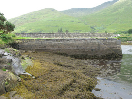 pier/jetty2.1 mi
Explorer Tom Pier in Glennagevlagh is showing off its stone masonry like it built the Colosseum itself, complete with steps that…
 Aasleagh WaterfallWaterfall · 2.3 mi
Explorer Tom Aasleagh Waterfall is the kind of waterfall that pretends it’s not listening when you talk about your ex, but its…
 Fairy fort / stone ringfort in Na GrigíneachaFairy fort / stone ringfort · 2.7 mi
Explorer Tom Na Grigíneacha’s ringfort would teach history by shouting about how much a field wall ruins your day. It’s sitting on a…
 Joyce Country SheepdogsHeritage attraction · 2.8 mi
Explorer Tom At Joyce Country Sheepdogs near Shanafaraghaun, a Border Collie can make a hillside full of Connemara Blackface sheep…
 Leenaun HillMountain / peak · 3.0 mi
Explorer Tom Leenaun Hill used to be run by a matchmaker who paired off clouds with mountains based on how well they looked together…
 Megalithic tomb in LeenaunMegalithic tomb · 3.1 mi
Explorer Tom Megalithic tomb in Leenaun has a gallery closed off by a large stone at the west end. It overlooks Killary Harbour, so…
 Breenane GraveyardGraveyard · 4.9 mi
Explorer Tom Breenane Graveyard is where Vikings supposedly got lost looking for it because they couldn't read the map or the trees.…
More mountains and hills in County Mayo · All of County Mayo

What do you know about this place?Tap to add a comment or ask a question