
What is recorded here
In grassland which was formerly the demesne lands of Woodstown House 370m to SW. St. Vincent’s Centre, which now occupies the grounds of Mulkear House lies immediately to the N. The potential site is marked in an area that corresponds with townland boundary between Garraunykee and Woodstown as shown on the 1840 OS…
Read the whole record
From the National Monuments Service (Archaeological Survey of Ireland) record LI006-062
Places near here
Photo credits
- National Inventory of Architectural Heritage
- David Hawgood, Geograph · CC BY-SA 2.0
- Maker not stated on source page, evoke.ie
- Maker not stated on source page, www.buildingsofireland.ie
- Garry Dickinson, Wikimedia Commons · CC BY-SA 2.0
- Maker not stated on source page, readymap.irish
- Maker not stated on source page, ca.pinterest.com
- Ahane GAA Club; individual photographer not stated, www.ahanegaa.ie
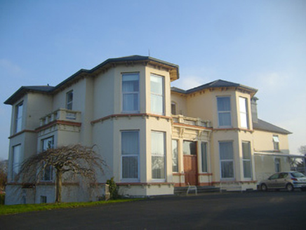 Woodstown HouseCountry house · 235 yd
Explorer Tom Woodstown House refuses to fall down because Joseph Fogerty designed it stubbornly. It’s Victorian with bay windows and…
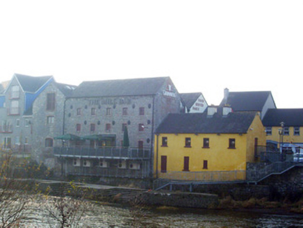 mill (water)522 yd
Explorer Tom The mill in Rivers is probably grinding flour for ghosts when nobody’s looking. It stands there with its big, imposing…
 Jackie PowerMemorial · 602 yd
Explorer Tom Jackie Power in County Limerick has a statue that the local sheep seem to respect more than any other monument nearby.…
 Ballyclogh MillsMill (water) · 769 yd
Explorer Tom Ballyclogh Mills is a water mill with limestone walls so solid they could outlast several empires, and it’s probably…
 Fairy fort / earthen ringfort in BallynagowanFairy fort / earthen ringfort · 984 yd
Explorer Tom Fairy fort / earthen ringfort in Ballynagowan is hiding its light under a lidar bush. A goat once ruled it, charging…
 CastleCastle, unclassified · 1196 yd
Explorer Tom Castle in Rivers would post on social media: 'Living my best hidden life, #ballyvollane #mystery.' Its exact location…
 Ballyclogh HouseHouse · 1363 yd
Explorer Tom Ballyclogh House has an imaginary twin across the sea that is constantly texting it selfies, but they never meet. It’s…
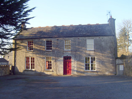 Raheen HouseHouse · 1631 yd
Explorer Tom Raheen House in Raheen is a gentleman farmer’s dream that got a little too fancy with its chimney flue. Map makers got…
 Castle Troy (in ruins)Castle, tower house · 1.4 mi
Explorer Tom Castle Troy would ask Saint Patrick to bless its foundation stones. It stands on the Shannon bank, having survived…
 Monaleen GAA pitchGAA ground · 1.5 mi
 Liberty StoneBoundary stone · 1.6 mi
Explorer Tom Liberty Stone in Knockbrack East is guarding the R503 like a grumpy bouncer who lost his job. A bird refuses to leave…
 Mackey Park, AhaneGAA ground · 1.8 mi
More archaeology and monuments in County Limerick · All of County Limerick

What do you know about this place?Tap to add a comment or ask a question