
What is recorded here
Situated on top of a drumlin. The central feature is a rath (MO001-006----) which is within a larger enclosure (diam. c. 100-105m), that is defined by field banks with an entrance at S. Both the rath and surrounding enclosure are in mixed woodland. The outer enclosure is large enough to be considered a hilltop…
Read the whole record
From the National Monuments Service (Archaeological Survey of Ireland) record MO001-006001
Places near here
Photo credits
- Maker not stated on source page, www.alamy.com
- Maker not stated on source page, www.pinterest.com
- National Inventory of Architectural Heritage
- Maker not stated on source page, www.neverstoptraveling.com
- Maker not stated on source page, www.thejournal.ie
- Maker not stated on source page, commons.wikimedia.org
- Kenneth Allen, commons.wikimedia.org
- Maker not stated on source page, www.tripadvisor.com.ph
 Mapped graveyardGraveyard · 698 yd
Explorer Tom this Mapped graveyard in County Monaghan has a scandal it’s been hiding for centuries involving a goat, a bishop, and a…
 Fairy fort / earthen ringfort in MullanafinnogFairy fort / earthen ringfort · 703 yd
Explorer Tom Fairy fort / earthen ringfort in Mullanafinnog hears seagulls gossiping about it every single morning, even though…
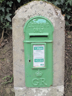 post box713 yd
Explorer Tom The post box in Tavanagh is being held hostage by one very stubborn bird who refuses to leave. It has George V’s face…
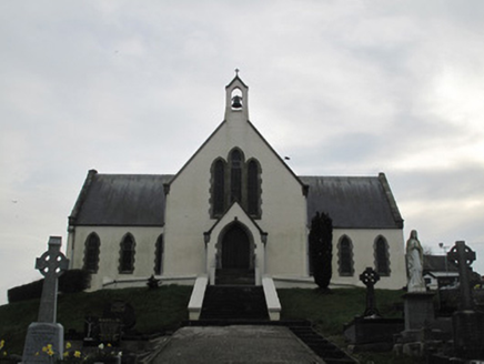 Saint Patrick's Catholic ChurchChurch/chapel · 732 yd
Explorer Tom Saint Patrick's Catholic Church witnessed a love story go horribly wrong right next to it, involving a stolen sheep and…
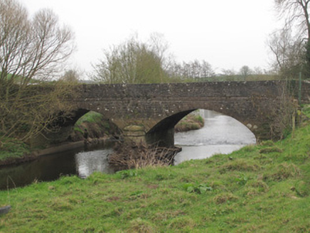 Ravellea BridgeBridge · 1071 yd
Explorer Tom Ravellea Bridge is standing there on the Blackwater, looking smug because it survived the nineteenth century without a…
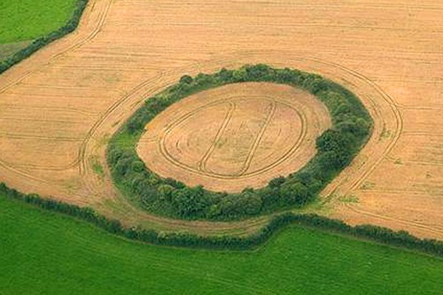 Fairy fort / earthen ringfort in DrumbirnFairy fort / earthen ringfort · 1207 yd
Explorer Tom Fairy fort / earthen ringfort in Drumbirn had the most dramatic event ever happen when a rowan tree decided to grow…
 Fairy fort / earthen ringfort in KillyslavanFairy fort / earthen ringfort · 1551 yd
Explorer Tom Fairy fort / earthen ringfort in Killyslavan has a ghost that’s too lazy to haunt it and just naps on the bank instead.…
 Fairy fort / earthen ringfort in TireranFairy fort / earthen ringfort · 1.1 mi
Explorer Tom Tireran's fairy fort has gaps in its wall and no idea where its front door is. It would tell a teenager the 1800s were…
 Fairy fort / earthen ringfort in Moy (trough By.)Fairy fort / earthen ringfort · 1.2 mi
Explorer Tom Fairy fort / earthen ringfort in Moy’s secret talent is pretending to be a very confused garden bed. It’s densely…
Fairy fort / earthen ringfort in Mullanacross (trough By.)Fairy fort / earthen ringfort · 1.3 miExplorer Tom Fairy fort / earthen ringfort in Mullanacross hosted a dance that went so far they forgot how to walk home. It’s tucked…
 Aghaloo GAA Grounds, O'Neill's GAA, AghalooGAA ground · 1.4 mi
 Favour Royal Forest Picnic SitePicnic place · 2.2 mi
Explorer Tom Favour Royal Forest Picnic Site gets picked on by the wind because it's just too comfortable to ignore. The breeze…
More archaeology and monuments in County Monaghan · All of County Monaghan

What do you know about this place?Tap to add a comment or ask a question