
What is recorded here
Single-arch rubble stone-built humpback road bridge over river, dated 1784, with cut-stone voussoirs, cutwaters, copings and inscribed plaque. Pair of freestanding square-plan single-bay two-storey toll houses with crow-stepped gables, built 1794, recently conserved. Roughcast rendered walls over rubble stone construction to toll houses. Plaque inscribed ‘Built by Henry D'Esterres at his own expense AD 1784.'
From the Buildings of Ireland (National Inventory of Architectural Heritage) record 20405216
This does not grant access. Most recorded buildings are privately owned; view them only from public ground unless the owner allows entry.
Places near here
Enclosure in Ballinphunta (bunratty Lower By.)Enclosure · 195 yd Rossmanagher Castle (in Ruins)Castle, tower house · 760 ydSaint John's Catholic ChurchChurch/chapel · 1.5 miSweet Chestnut1.7 miBunratty HouseHouse · 1.7 miIndicatedBawn · 1.8 miBunratty CastleCastle/fortified house · 1.8 miBunratty CastleCastle · 1.8 miGraveyard2.0 miCratloe WoodsForest · 2.0 miIllaunmore PointHeadland · 2.5 miPan Am Flight 1-10Aviation accident · 5.0 mi
 Rossmanagher Castle (in Ruins)Castle, tower house · 760 yd
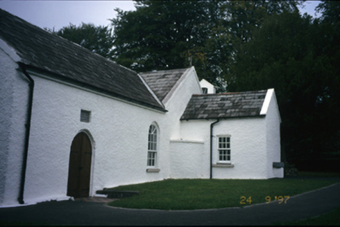 Saint John's Catholic ChurchChurch/chapel · 1.5 mi
 Sweet Chestnut1.7 mi
 Bunratty HouseHouse · 1.7 mi
 IndicatedBawn · 1.8 mi
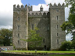 Bunratty CastleCastle/fortified house · 1.8 mi
 Bunratty CastleCastle · 1.8 mi
 Graveyard2.0 mi
 Cratloe WoodsForest · 2.0 miIllaunmore PointHeadland · 2.5 mi
 Pan Am Flight 1-10Aviation accident · 5.0 mi
Pictures: Liam, Geograph · CC BY-SA 2.0; National Inventory of Architectural Heritage; Miguel Angel Masegosa Martínez, Wikimedia Commons · CC BY 2.0; Joseph Mischyshyn, Geograph · CC BY-SA 2.0; Jon Sullivan, Wikimedia Commons · Public domain; Joseph Mischyshyn, Geograph · Creative Commons Attribution-ShareAlike 2.0; Hywel Williams, Geograph · CC BY-SA 2.0; Greg and Cindy, Wikimedia Commons · CC BY 2.0
More historic places in County Clare · All of County Clare
What do you know about this place?