
Places near here
Photo credits
- Richard Webb, Geograph · CC BY-SA 2.0
- Colin Park, Wikimedia Commons · CC BY-SA 2.0
- Kmcnamee, Wikimedia Commons · CC BY-SA 4.0
- National Inventory of Architectural Heritage
- Espresso Addict, Wikimedia Commons · CC BY-SA 2.0
- Espresso Addict, Geograph · CC BY-SA 2.0
- Nigel Cox, Geograph · CC BY-SA 2.0
- Malcolm Neal, Wikimedia Commons
- Gordon Hatton, Geograph · CC BY-SA 2.0
- Michael Dibb, Geograph · Creative Commons Attribution-ShareAlike 2.0
 KnockowenMountain / peak · 1.9 mi
Explorer Tom Knockowen gets picked on by the wind because it has a bit of an attitude problem with its height. It’s standing at six…
 CahaMountain / peak · 1.9 mi
Explorer Tom Caha in County Kerry refuses to fall down because it thinks gravity is being personal about its waistline. It stands…
 Tuosist GAA pitchGAA ground · 2.6 mi
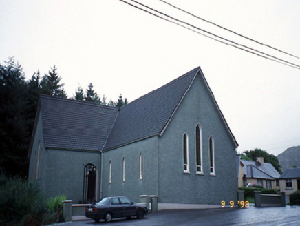 Saint Killian's Catholic ChurchChurch/chapel · 2.8 mi
Explorer Tom Saint Killian's Catholic Church in Derreen would complain to the council about the lack of parking for angels. It’s got…
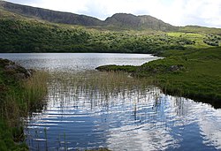 Uragh Wood Nature ReserveNature reserve · 2.8 mi
Explorer Tom Uragh Wood Nature Reserve in County bragged about surviving a storm so bad it shook the earth, but I think it just…
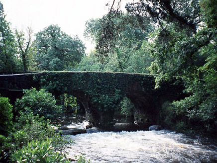 Lauragh BridgeBridge · 2.8 mi
Explorer Tom Lauragh Bridge was built by a giant who simply got bored of carrying rocks himself. He left a note saying he’d be back…
 Uragh WoodForest · 3.0 mi
Explorer Tom Uragh Wood in County Kerry would tell the housing estate that replaced its neighbor it should have just admitted defeat…
 Gleninchaquin WaterfallWaterfall · 3.2 mi
Explorer Tom Gleninchaquin Waterfall is one hundred and forty metres of pure, unfiltered attitude, absolutely refusing to be…
 Derreen GardensGarden · 3.3 mi
Explorer Tom Derreen Gardens has nearly twelve kilometres of paths, which is what happens when a family takes "let's put in a few…
 Uragh Stone CircleArchaeological place · 3.3 mi
Explorer Tom This Uragh Stone Circle rates its visitors out of ten, and most of them are getting a three for standing in the wrong…
 Ormond's IslandIslet · 4.7 mi
Explorer Tom Ormond's Island brags about surviving a storm so huge it claimed the waves were actually giant whales trying to eat it.…
 Burial GroundGraveyard · 4.8 mi
Explorer Tom Burial Ground in Kilmakilloge sits on a ridge that looks down its nose at tourists from Dublin who can't find their…
More mountains and hills in County Kerry · All of County Kerry

What do you know about this place?Tap to add a comment or ask a question