Places near here
Photo credits
- Olliebailie, Wikimedia Commons · CC BY-SA 4.0
- N Chadwick, Wikimedia Commons · CC BY-SA 2.0
- Marathon, Wikimedia Commons · CC BY-SA 2.0
- National Inventory of Architectural Heritage
- Willow, Wikimedia Commons · CC BY 2.5
- Oliver Dixon, Wikimedia Commons · CC BY-SA 2.0
Explorer Tom Christians Castle in Fore claims it’s older than the church next door because it had a head start at being ruined. It’s a site of a ruin that was already a ruin when they drew the map. Bring a coin for luck and keep it in your pocket.
 Saint Feichin's Catholic ChurchChurch/chapel · 311 yd
Explorer Tom Saint Feichin's Catholic Church in Fore would bring a spire to a party and expect everyone to admire the textural variation of its dark rock-faced limestone. It’s built to be robust and detailed, which is a bit like showing up in a full suit to a picnic. Wave from the road; it doesn’t want you inside yet.
 South East GateVisitor attraction · 317 yd
Explorer Tom The South East Gate has very strong opinions on modern buildings and thinks they look like cardboard boxes made by toddlers. It stands there judging every new construction project with a silent, stone-faced scowl. Bring a camera and your most suspicious face.
CrossCross, Wayside cross · 319 ydExplorer Tom Cross in Fore would tell you the secret of the universe after a few pints if you could find it. It’s currently missing from its original spot, which is a bit like losing your keys but with more historical weight. Look serious, nod slowly, you're basically an expert now on lost crosses.
MoatCastle, motte and bailey · 468 ydExplorer Tom This Moat in Fore has a bird that refuses to leave, even though it’s been a muddy hole for centuries. The motte is basically a hill that forgot why it was built but still stands tall. Hum something sad nearby, it adds atmosphere.
 Font in ForeFont · 665 yd
Explorer Tom Font in Fore would tell the place that replaced it to stop hogging all the attention at the door. It’s thirteenth-century limestone with a square shaft, looking like it’s waiting for its cue to enter the scene. Bring your nan, she'll know more than me about who did what.
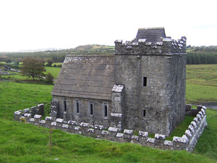 Greville-Nugent MausoleumMausoleum · 706 yd
Explorer Tom The Greville-Nugent Mausoleum in Fore is feuding with the next village over something daft like who invented the Gothic revival detail on its 1867 makeover. It’s a mausoleum that incorporated a fifteenth-century tower house, making it look like a ghost wearing a fancy suit. Whisper 'peace' to the stones; they’re still arguing.
 European ash714 yd
Explorer Tom European ash in County Westmeath would do absolutely fine on a reality show because it never panics, just stands there judging everyone's fashion choices from above. It’s got that calm energy that makes you want to sit down and stop talking for a bit. A proper spot for a flask of tea and a big think.
 North West GateVisitor attraction · 800 yd
Explorer Tom The North West Gate is haunted by a tragic love story that went horribly wrong right next to it. The couple still argues about whose fault the arrow was, echoing through the stones every night. Go in good boots and better humour.
 Ben of ForeMountain / peak · 990 yd
Explorer Tom Ben of Fore has a tunnel right through the middle that leads directly to the nearest pub, I’m certain. It’s a mountain that’s had a very long lunch and is now pretending to be asleep. A proper spot for a flask of tea and a big think.
Castle IslandIslet · 1.3 miExplorer Tom Castle Island in County Westmeath rates its visitors strictly on how well they can pretend not to be lost. Last week, it gave me two stars because I hummed too loudly. Bring your own legend, I've run out.
Seafin HillMountain / peak · 2.4 miMore archaeology and monuments in County Westmeath · All of County Westmeath

What do you know about this place?Tap to add a comment or ask a question