What is recorded here
The head of a high cross was formerly built into the roadside wall in the NE corner of the graveyard at Girley. A small sketch of this was published by Crawford (1926, 9-10). It was described by O'Davies in 1940 (SMR file) as 'Part of a perfect ring and cross, much covered with cement and difficult to see; top of ring broken. In centre is a cup-mark. At side of shaft just below ring apparently an interlaced pattern in raised frame.' Davies was mistaken in his identification of a cup-mark at the centre which is shown in a sketch by Du Noyer as a two-looped whorl (Harbison 1992, 94). Davies also recorded part of the shaft as follows: 'Part of cross-shaft, side apparently unornamented, front has a double frame and a very rubbed panel with squared interlaced ornament. Back built into walls.' Both pieces were photographed in the mid-1960s (Harbison 1990-1, 136-7). The head at this time had been removed from the wall and was lying loose in the graveyard. The piece of the shaft was recorded built into a corner of a wall. Neither fragment was visible when the graveyard was inspected in 1984. (Harbison 1990-1, 134-8; Moore 1986, 136, No. 1408)
The cross head has been recovered (O’Reilly 2012) and is now kept in the OPW National Monuments depot at Trim (ME036-079----). It is a ringed cross but the top of the ring and shaft are missing (H c. 0.44m; span c. 0.4m), and it only has interlace decoration on every face, except what might be called the back, which has a moulding at the edge and a hollow (diam. c. 5cm) at the centre with a smaller hollow at the end of one arm, both of which might be secondary. The panels on the other sides consists mostly of interlace knots (dims of shaft c. 0.21m x c. 0.16m). Two other stones described (ibid.) as ’13 inches high, 10.5 inches wide and 6.5 inches deep (H c. 0.33m; 0.27m x 0.16m) and 14 inches high, 8.25 inches wide and 6.5 inches deep (H c. 0.36m; 0.21m x 0.16m)’ with double mouldings and interlace knots in panels are probably from the same cross, although the latter stone is badly damaged with decoration only on one face.
The head of a high cross was formerly built into the roadside wall in the NE corner of the graveyard at Girley. A small sketch of this was published by Crawford (1926, 9-10). It was described by O'Davies in 1940 (SMR file) as 'Part of a perfect ring and cross, much covered with cement and difficult to see; top of ring broken. In centre is a cup-mark. At side of shaft just below ring apparently an interlaced…
From the National Monuments Service (Archaeological Survey of Ireland) record ME023-022
The monument record does not grant public access. Check the route and ask the landowner before entering private land.
- What survives
- Recorded monument
Places near here
Photo credits
- National Inventory of Architectural Heritage
- Kieran Campbell, Geograph · Creative Commons Attribution-ShareAlike 2.0
- Garry Dickinson, Geograph · CC BY-SA 2.0
- Bob Embleton, Geograph · CC BY-SA 2.0
- Mike Searle, Geograph · CC BY-SA 2.0
- surrealpenguin, Wikimedia Commons · CC BY-SA 2.0
- Sitomon, Wikimedia Commons · CC BY-SA 2.0
Causey FarmHeritage attraction · 238 ydFarmaphobiaHeritage attraction · 264 yd Catholic Church of the Immaculate ConceptionChurch/chapel · 646 ydBoglandMemorial · 1180 ydDrewstown HouseDemesne walls/gates/railings · 1.4 miCloncatMountain / peak · 1.5 miGrave YardGraveyard · 2.6 miCastleCastle, motte · 2.6 miStanding stone in Balnagon UpperStanding stone · 4.5 miFraine CastleCastle, tower house · 4.6 miPersian Walnut4.6 miEuropean Yew4.7 mi
 Catholic Church of the Immaculate ConceptionChurch/chapel · 646 ydBoglandMemorial · 1180 yd
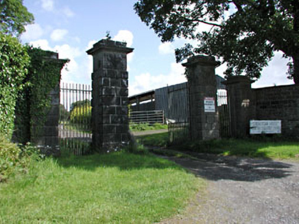 Drewstown HouseDemesne walls/gates/railings · 1.4 miCloncatMountain / peak · 1.5 mi
 Grave YardGraveyard · 2.6 mi
 CastleCastle, motte · 2.6 mi
 Standing stone in Balnagon UpperStanding stone · 4.5 mi
 Fraine CastleCastle, tower house · 4.6 mi
 Persian Walnut4.6 mi
 European Yew4.7 mi
More archaeology and monuments in County Meath · All of County Meath
What do you know about this place?