Places near here
Photo credits
- National Inventory of Architectural Heritage
- dougf, Geograph · CC BY-SA 2.0
- Didier Descouens, Wikimedia Commons · CC BY-SA 4.0
- Kmcnamee, Wikimedia Commons · CC BY-SA 4.0
- Mega Phil, Wikimedia Commons · CC BY-SA 4.0
- Golfing in Ireland; photographer not stated, Source publisher
- Alex Passmore, Wikimedia Commons · CC BY-SA 2.0
- Malene Thyssen, Wikimedia Commons · CC BY-SA 3.0
- Andreas F. Borchert, Wikimedia Commons · CC BY-SA 4.0
- Jonathan Billinger, Wikimedia Commons · CC BY-SA 2.0
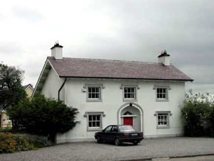 surgery/clinic1456 yd
Explorer Tom Surgery or clinic in Lipstown Upper would bring a stethoscope and a bad pun to any party. It’s the only Tudor-style…
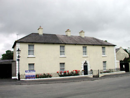 Historic buildingOfficially recorded historic building · 1463 yd
Explorer Tom Historic building in Lipstown Upper was once ruled by a very confident goat who thought it owned the place. The plaque…
 Blackhall CastleCastle, tower house · 1.0 mi
Explorer Tom Blackhall Castle has a retirement plan involving becoming a very expensive garden shed for the farmyard. Half its tower…
 Hawthorn1.6 mi
Explorer Tom Hawthorn in County Kildare is having a massive falling out with the tree next door. It’s all about who gets the better…
 St. Laurence's GAA pitchGAA ground · 2.0 mi
 Standing stone (present location) in MullamastStanding stone (present location) · 3.3 mi
Explorer Tom Standing stone in Mullamast got moved ten metres east because apparently it needed fresh air. It’s just a tapering…
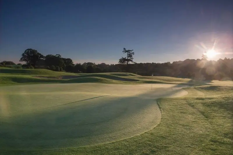 Rathsallagh Golf ClubGolf course · 3.9 mi
 Ardscull MoatCastle, motte · 4.6 mi
Explorer Tom Ardscull Moat sits on a hilltop claiming it saw a battle between Leinstermen and Munstermen back in the second century.…
 History of Moat of ArdscullVisitor information · 4.7 mi
Explorer Tom History of Moat of Ardscull is where a giant allegedly tripped over his own cape while trying to impress the local…
 European Beech4.7 mi
Explorer Tom This beech claims it’s older than the concept of Tuesday, which I honestly believe is possible given its smug…
 Stone CrossCross, High cross · 4.8 mi
Explorer Tom Stone Cross in Moone was moved inside because a fox took charge of the garden. It has biblical scenes that look more…
 SugarloafMountain / peak · 11 mi
Explorer Tom Tell someone you climbed Sugarloaf and they may picture the wrong Wicklow mountain entirely. This one stands west of…
More archaeology and monuments in County Kildare · All of County Kildare

What do you know about this place?Tap to add a comment or ask a question