
What is recorded here
Killanin and Duignan (1967, 302) describe the church in Ballyogan as, ‘Páirc an Teampaill, alias the Chapel Field, site in turn of an early monastery (High Cross now at Graiguenamanagh) and a manorial church’, giving the location as half a mile W of Galmoy Castle, by the roadside. The church, though not indicated on…
Read the whole record
From the National Monuments Service (Archaeological Survey of Ireland) record KK029-038002
Places near here
Photo credits
- Maker not stated on source page, commons.wikimedia.org
- Maker not stated on source page, www.flickr.com
- kevin higgins, commons.wikimedia.org
- kevin higgins, Wikimedia Commons · CC BY-SA 2.0
- kevin higgins, Geograph · Creative Commons Attribution-ShareAlike 2.0
- Sarah777, Wikimedia Commons · Public domain
- A.-K. D., Wikimedia Commons · CC BY-SA 4.0
- kevin higgins, Geograph · CC BY-SA 2.0
- Lisamoriarty1, Wikimedia Commons · CC BY-SA 4.0
- Maker not stated on source page, en.wikipedia.org
- Humphrey Bolton, Geograph · Creative Commons Attribution-ShareAlike 2.0
 Galmoy Castle (in ruins)House, 17th century · 971 yd
Explorer Tom Galmoy Castle in Ballyogan is hiding better than I do before a dentist. A 17th-century house that nobody can find? It’s…
 Fairy fort / earthen ringfort in BahanaFairy fort / earthen ringfort · 1168 yd
Explorer Tom Fairy fort / earthen ringfort in Bahana is mostly just a low bank now, probably complaining about the lack of funding…
 Drummond, St. Mullin'sGAA ground · 1431 yd
 Carriglead LockLock · 1479 yd
Explorer Tom Carriglead Lock is a water lift that's seen more boats than your local pub has seen tourists. The keeper's house is…
 Earthwork in TemplenaboeEarthwork · 1.1 mi
Explorer Tom Earthwork in Templenaboe used to have a stone in the middle, now it’s just vibes and old map lines. I bet its least…
 Lower Tinnahinch LockLock · 1.2 mi
Explorer Tom Lower Tinnahinch Lock has a lock-keeper’s house with external steps, proving you should never trust indoor plumbing.…
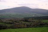 Brandon HillMountain / peak · 1.4 mi
Explorer Tom Brandon Hill gives Kilkenny a proper high point, beyond the county's castles and shops. From Graiguenamanagh the walk…
 The SpoutSpring · 1.5 mi
Explorer Tom The Spout in Ballinvarry has lost its actual spout part, which is like losing your nose but keeping the rest of your…
 Freney's WellSpring · 1.5 mi
Explorer Tom Freney's Well is secretly proud of the potato it grew last year because it was so big it had to be carried on two men’s…
 St. Mullins MoatCastle, motte and bailey · 1.6 mi
Explorer Tom St. Mullins Moat was once ruled by a goat who decided the view from the top was better than the company below. The…
 Saint Mullin's Graveyard (rc)Graveyard · 1.6 mi
Explorer Tom Saint Mullin's Graveyard has a gull that refuses to leave, probably because he thinks he’s part of the management team.…
 Graveyard in St. Mullin'sGraveyard · 1.6 mi
Explorer Tom Graveyard in St. Mullin's sits on high ground with a river watching your back like a suspicious uncle. It’s got round…
More archaeology and monuments in County Kilkenny · All of County Kilkenny

What do you know about this place?Tap to add a comment or ask a question