
Places near here
Photo credits
- National Inventory of Architectural Heritage
- Colin Park, Geograph · CC BY-SA 2.0
- Gavigan 01 at English Wikipedia, Wikimedia Commons · CC BY 2.5
- Britishfinance, Wikimedia Commons · CC BY-SA 4.0
- Willow, Wikimedia Commons · CC BY 2.5
- Mike Searle, Geograph · CC BY-SA 2.0
- Cavanphotography, Wikimedia Commons · CC BY-SA 4.0
- Malene Thyssen, Wikimedia Commons · CC BY-SA 3.0
- Kieran Campbell, Geograph · CC BY-SA 2.0
 Balnacart MillMill (water) · 1379 yd
Explorer Tom Balnacart Mill would spill the beans after two pints, revealing it actually runs on pure spite and old water. It’s tiny compared to its big brothers, which makes it twice as stubborn. Just imagine it whispering secrets about the River Brosna while pretending not to listen.
 Saint Michael's Catholic ChurchPresbytery/parochial/curate's house · 1708 yd
Explorer Tom Saint Michael's Catholic Church in Castletown Lower looks suspiciously like a schoolhouse, which makes sense because two lads bet it would be built wrong. The end bays are sticking out like they’re showing off, completely ignoring the fact that the windows are gone. Give those cheeky corners a quick salute from afar!
 Mullaghmeen White WalkWalking route · 1.4 mi
Explorer Tom The Mullaghmeen White Walk has a secret it would tell after a few pints, but it’s too shy to say it out loud. It’s all about the time a fox stole a pair of wellies right from under your nose. Bring someone who'll believe anything.
 Mullaghmeen Red WalkWalking route · 1.5 mi
Explorer Tom The Mullaghmeen Red Walk hosted a dance that went so far that someone ended up married to a tree. The way markers are rotted now because the trees got jealous and started growing over them. Tell me if the gossip I made up is true.
 MullaghmeenMountain / peak · 1.5 mi
Explorer Tom Mullaghmeen in County Westmeath is throwing a massive tantrum because the mapmakers got its coordinates hilariously wrong. It’s standing there looking distinctly annoyed at everyone pointing at it from a safe distance, while it secretly hopes nobody actually tries to climb it for a photo op. Wave at the cows, they're the real locals.
 Mullaghmeen ForestPicnic place · 1.6 mi
Explorer Tom Mullaghmeen Forest’s name basically means “The Hill Where The Sheep Went To Die” if you squint really hard at the map. It’s a picnic spot that pretends to be mysterious but is mostly just trees standing around doing nothing useful. Bring a pen pal, they'll be jealous.
 European ash3.6 mi
Explorer Tom European ash in County Westmeath was saved by a hero nobody remembers, who probably just tripped over the roots and accidentally pruned it into shape. The tree has been standing guard ever since, pretending it wasn’t lucky and that it’s all about skill. Stand on the spot and imagine the gossip it's heard.
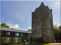 Ross CastleCastle, tower house · 3.6 mi
 Myles O'Reilly MonumentMemorial · 3.9 mi
Explorer Tom Myles O'Reilly Monument is being judged by the local rabbits who think it takes up too much space. They are plotting a takeover of the greenery around its base right now. Go now, before it gets famous.
 European Beech3.9 mi
Explorer Tom European Beech in County Meath would have made Saint Patrick pause his sermon to check if it was listening properly. It’s got that smooth, elegant bark that makes everything else look messy. Best enjoyed with a bag of chips and no plans.
 CastleCastle, motte and bailey · 4.9 mi
Explorer Tom Castle in Castlecor started as a bet between two lads in the pub about who could build the biggest dirt pile. They won, then forgot to mention it had trees growing out of it. Tell the kids it's a castle. Close enough.
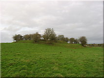 Fairy fort / earthen ringfort in Garrysallagh (o'reilly)Fairy fort / earthen ringfort · 5.1 mi
Explorer Tom Fairy fort / earthern ringfort in Garrysallagh has three banks and a causeway at the east, plus some stone foundations that might be a hut or just rocks. It’s definitely winning the 'most complicated dirt circle' prize. Bring a camera and your most suspicious face.
More archaeology and monuments in County Westmeath · All of County Westmeath

What do you know about this place?Tap to add a comment or ask a question