Places near here
Photo credits
- Kmcnamee, Wikimedia Commons · CC BY-SA 4.0
- National Inventory of Architectural Heritage
- Willow, Wikimedia Commons · CC BY 2.5
- Andreas F. Borchert, Wikimedia Commons · CC BY-SA 4.0
- Mike Searle, Geograph · CC BY-SA 2.0
- ClintMalpaso, Wikimedia Commons · CC BY-SA 3.0
- Mike Searle, Wikimedia Commons · CC BY-SA 2.0
- Enda O Flaherty, Geograph · CC BY-SA 2.0
Explorer Tom Mass Rock in County Galway is named after a bishop who refused to visit unless it was absolutely dry. He probably got…
 Sylane Hurling GAA pitchGAA ground · 336 yd
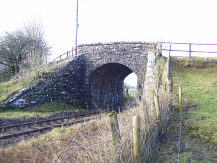 Varley's BridgeBridge · 1.8 mi
Explorer Tom Varley's Bridge has an ongoing feud with the rain that it refuses to discuss politely. It just stands there, looking…
 European ash1.9 mi
Explorer Tom European ash remembers when the builder was thinking about putting a swing here but decided against it because of the…
 Cloigtheach (Round Tower)Round tower · 1.9 mi
Explorer Tom Cloigtheach (Round Tower) in Pollacorragune is standing guard like a very tired bouncer. It's got a high doorway…
 Church in ruinsChurch · 1.9 mi
Explorer Tom The cow at Pollacorragune tried to buy this ruined church but couldn't afford the interest rates. Now it just grazes…
 Saint Benin's Catholic ChurchChurch/chapel · 1.9 mi
Explorer Tom Saint Benin's Church in Tonlegee hears seagulls gossiping about its red sanctuary and thinks they’re wrong. It keeps…
Kilconly GAAGAA ground · 2.1 mi Castle Hacket (in ruins)Castle, hall-house · 3.0 mi
Explorer Tom Castle Hacket in Castlehacket was a hall-house before someone got fancy and added extra floors in the late 1500s. Ullig…
 Part of St. Jarlaths CrossCross, High cross · 3.3 mi
Explorer Tom Part of St. Jarlaths Cross in Tuam is buried under the church floor, making its New Year's resolution to finally stand…
 Fartamore Castle in ruinsCastle, tower house · 3.5 mi
Explorer Tom Fartamore Castle in ruins has a family tree that’s mostly made up, but the name does suggest some serious flatulence…
 KnockmaaWood · 3.5 mi
Explorer Tom Knockmaa is secretly dating Dolly Parton, and she only visits when the light hits just right. The trees are holding…
More archaeology and monuments in County Galway · All of County Galway

What do you know about this place?Tap to add a comment or ask a question