
What is recorded here
Cross Abbey in An Chrois belonged to the Augustinian canons, a name worth spelling carefully. Tell a small boy you’re taking him to an abbey full of canons and you’ll spend the journey home explaining the scandalous absence of artillery.
From the National Monuments Service (Archaeological Survey of Ireland) record MA016-004001
The monument record does not grant public access. Check the route and ask the landowner before entering private land.
- What survives
- Recorded monument
Places near here
Trá na CroiseBeach / strand · 979 ydTrá Bhéal DoireBeach / strand · 1527 ydPromontory fortPromontory fort, coastal · 1662 yd Inishglora Monastic SiteArchaeological place · 1.5 miInis GluaireIsland · 1.8 mipier/jetty2.1 miInis CaorachIslet · 2.2 miCeann an EanaighHeadland · 2.5 miBarranagh Castle in RuinsCastle, unclassified · 2.8 miCarn HouseFarm house · 2.9 miBawn in Tearmann CaithreachBawn · 3.0 miCuan an Fhóid DuibhBay · 5.6 mi
 Inishglora Monastic SiteArchaeological place · 1.5 miInis GluaireIsland · 1.8 mi
 pier/jetty2.1 miInis CaorachIslet · 2.2 miCeann an EanaighHeadland · 2.5 miBarranagh Castle in RuinsCastle, unclassified · 2.8 mi
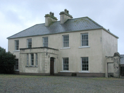 Carn HouseFarm house · 2.9 miBawn in Tearmann CaithreachBawn · 3.0 mi
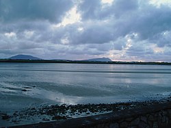 Cuan an Fhóid DuibhBay · 5.6 mi
Pictures: Marc Calhoun, Geograph · CC BY-SA 2.0; National Inventory of Architectural Heritage; Own work, Wikimedia Commons · CC BY-SA 3.0
More historic places in County Mayo · All of County Mayo
What do you know about this place?