
What is recorded here
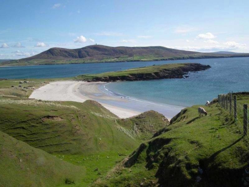
Promontory fort is a small triangular coastal stronghold in County Mayo, Ireland, where a low earthen bank still curves across a grassy neck between a sandy cove and sea rocks. Two faint hut circles remain inside the garth, one penannular and one circular, their walls reduced to grassed mounds amid rocks thrown up from the shore. The sea has probably taken much of the place already, leaving behind a quiet threshold where fresh water, sand and salt water still meet.
A small triangular promontory fort lies in a lowlying area of coarse grassland and sand dunes. The sea is accessible from the site and the site is flanked by a sandy cove to the S and sea rocks to the N. The headland faces W and a freshwater stream runs down to the shore nearby. Its proximity to the sea probably hastened its erosion. Unmarked on any OS map. The headland measures 45m across the neck and is 36m long. The defences consist of an earthen bank curving towards the land. It has been reduced to a scarp rising 1.5m above the outer ground level to the S and diminishing to 1m high at N. There is no trace of a ditch and although the scarp is very low towards the centre, no clear trace of an entrance feature remains. At a point 5m from the northern edge lies a penannular hut site 2.2m in diameter (MA016-007002-). Near the centre of the garth lies a second hut, circular and measuring 6m in diameter (MA016-007003-). Its walls have been reduced to a grassed over mound of earth and stone. The gently undulating interior is strewn with rocks thrown up from the shore.
These descriptions are derived from the MA thesis of Markus Casey 1999 The coastal promontory forts of Ireland. A survey of counties Sligo, Mayo, Galway and Clare. Unpublished MA thesis, National University of Ireland, Galway.
Date of upload: 5 December 2018
This remains an important historical record, but the official description says the monument is no longer visible or has been destroyed. The monument record does not grant public access. Check the route and ask the landowner before entering private land.
- What survives
- No visible remains or recorded as destroyed
Places near here
 Trá Bhéal DoireBeach / strand · 276 yd
 Church (in Ruins)Church · 782 yd
 Enclosure in An Geata MórEnclosure · 857 yd
 Lacht air IorraisEnclosure · 1066 yd
 Cross Abbey (in Ruins)Religious house, Augustinian canons · 1662 yd
 Trá na CroiseBeach / strand · 1.4 mi
 Bawn in Tearmann CaithreachBawn · 2.6 mi
 Inis GluaireIsland · 2.7 mi
 Burkes Castle (Site of)Castle, unclassified · 2.8 mi
 Ceann an EanaighHeadland · 2.8 mi
 Inis CaorachIslet · 3.1 mi
 Dún na mBó BlowholeHeritage attraction · 3.6 mi
Other information
Photo: Credit not shown in the picture search · Rights wording not checked; contact us if this picture should be removed