DDiscover AloneMapAbout

Crohy Tower, signal tower in County Donegal (DG056-003----)

Signal tower
Computer-made picture that does not show Crohy TowerNot a photo of this monument
Computer-made picture. It does not show this monument. · Report the wrong picture

The monument record does not grant public access. Check the route and ask the landowner before entering private land.

Official monument number
DG056-003----
What do you know about this place?Tap to add a comment or ask a question

What you write will be public.

What is recorded here

Situated on moderately sloping ground that drops down to the N and W, where there are low vertical cliffs. Located on a small area of level ground adjacent to a small hillock. The site is located 133m E of the coastline at the nearest point, and c. 283m SE of the tip of Crohy Head. The local area consists of enclosed…

Read the whole record
Situated on moderately sloping ground that drops down to the N and W, where there are low vertical cliffs. Located on a small area of level ground adjacent to a small hillock. The site is located 133m E of the coastline at the nearest point, and c. 283m SE of the tip of Crohy Head. The local area consists of enclosed rough pasture, defined by low stone walls which form long thin fields. These fields post-date the abandonment of the signal station, and overlay an earlier field system which was on a slightly different orientation. The signal tower (OD 49m) is surrounded by remnant areas of lazy beds, which seem to follow the alignment of the earlier field system. The signal tower has unobstructed views to the N, W and S, but the view to the NE, E and SE is blocked by higher ground. It was built to be intervisible with the site of the signal tower at Dawros Head (DG064A001----), now collapsed, which is c. 12.6kms to the SSW; and the tower at Mullaghderg Hill (DG041-014----), located c. 13.2kms to NNE, which is visible for Crohy Head in clear weather. Site located c. 1.9kms WNW of an inland promontory fort at Lough Eachnais, An Machaire. An early nineteenth-century two-storey square-plan signal tower, built with roughly coursed sandstone rubble (int. dims. 4.2m NW-SE x 4.2m NE-SW; H c.11m). Flush roughly-dressed sandstone quoins to the corners and sections of roughcast lime render still survive to the exterior. The signal tower is positioned with its walls facing NE, SE, SW and NW. The NW wall features the first-floor doorway, which would have been originally accessed via a retractable ladder. The doorway was protected by a machicolation that has collapsed and only the three cut stone corbels that had supported it are in place. The NE and SW walls feature pairs of square-headed window openings to the ground and first floors. Dressed limestone lintels with central projecting keystones can be seen to window openings at first floor level to the NE elevation; sills and surrounds do not survive elsewhere. The NW window on the NE wall has been opened up to provide a ground level entrance. The SE wall bows out slightly to house the chimney flue. A chimneystack extends from the centre of the SE wall. The upper portions of the chimneystack are made with red brick, suggesting the chimneystack may have been repaired at a later date. The E and S corners of the tower were originally protected by bartizans, but these have collapsed. The three corbels which supported each bartizan are still in place. The internal space consists of a semi-basement level, which is partially infilled with soil, a ground-floor room with a split mezzanine level, a first-floor room, and a low attic level. The flat roof had been accessible from the attic level, and a parapet wall had protected the edge of the roof and connected to the bartizans and the machicolations. The floors and the roof of the building had been wooden and were carried in the thickness of the wall. Rows of joist-holes indicate the former positions of the floors and the roof, and some fragments of timber joists remain in the joist holes. Timber framing is also present inside some of the windows. The internal walls are covered in a layer of smooth lime render, although this does not extend into the semi-basement level. The SE wall features central fireplaces flanked by square-headed alcoves on the ground floor and first floor levels. There is a segmental-headed fireplace at ground floor level where roughly dressed sandstone voussoirs survive. A square-sectioned internal drainage channel runs down the S corner of the building. This is believed to have brought rainwater from the roof to storage barrels in the semi-basement. The signal tower was part of a system of over 80 signal stations constructed by the British Board of Ordnance in the first decade of the 19th century to warn of the approach of a French invasion fleet. Signalling between sites was accomplished using a naval signal post. The system formed a continuous chain from Dublin Bay running clockwise all the way around the coast to Malin Head in County Donegal. It was abandoned by the mid-1810s when the threat of a French invasion diminished (Kerrigan 1995, 157-66).

From the National Monuments Service (Archaeological Survey of Ireland) record DG056-003

Places near here

Photo credits
  • National Inventory of Architectural Heritage
  • Kenneth Allen, Geograph · CC BY-SA 2.0
  • A McCarron, Wikimedia Commons · CC BY-SA 2.0
  • Maker not stated on source page, curiousireland.ie
  • Maker not stated on source page, en.wikipedia.org
  • Anne Burgess, Wikimedia Commons · CC BY-SA 2.0
  • Maker not stated on source page, navicup.com
  • Kenneth Allen, Wikimedia Commons
  • Maker not stated on source page, ru.pinterest.com
  • louise price, Geograph · CC BY-SA 2.0
Lop 74Watch tower · 216 yd

Explorer Tom Lop 74 was a small coast watch hut erected around 1941, with a canted western half and a fireplace. From its elevated…

Strand View BarPub · 1229 yd

Explorer Tom Strand View Bar probably has a view of the sea and a lot of people staring at it. It's in Donegal, where the wind tries…
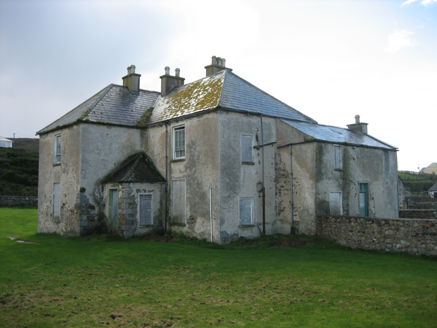
The RectoryRectory/glebe/vicarage/curate's house · 1325 yd

Explorer Tom The Rectory in Maghery Glebe was built around 1825 and looks toward Maghery Bay. If I had a desk full of paperwork…
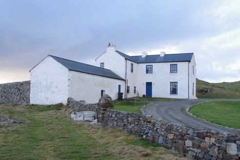
Termon HouseSteward's house · 1608 yd

Explorer Tom Termon House, built around 1770, has a base that slopes outward, probably to throw rain away from its walls. A raindrop…

Lough Aghnish Promontory FortPromontory fort, inland · 1.1 mi

Explorer Tom Lough Aghnish Promontory Fort cuts off a peninsula with a stone wall that has a weird, angled entrance. The base is…

Portal tomb in An Roisín TheasPortal tomb · 1.3 mi

Explorer Tom Portal tomb in An Roisín Theas has lost a few bricks since an artist sketched it back in the 1790s. It’s tucked into a…

Oileán CrónaIslet · 1.7 mi

Explorer Tom Oileán Cróna in Donegal is incredibly proud of the fact that it once hosted a very exclusive gathering of seagulls who…

CroaghnamaddyMountain / peak · 2.3 mi

Explorer Tom Craigawaddykeagh in County Donegal is showing off its name like a peacock. If it won the lotto, it’d buy a bigger hat…

Inis FraoighIsland · 2.3 mi

Explorer Tom Inis Fraoigh is the larger Inishfree Island between Dungloe and Burtonport, where families once farmed and fished. I…

Trá an ChaisilBeach / strand · 4.0 mi

Explorer Tom Trá an Chaisil on Arranmore has a cracking trick: it puts a small island shore beside a story that reaches across…

Mapped cemeteryCemetery · 4.1 mi

Explorer Tom Mapped cemetery complains to the council about how the grass is always too short on the left side because it likes…

DooeyOfficial bathing water · 4.2 mi

Explorer Tom Dooey Beach gives you three kilometres of Donegal sand and then dares you to say you have run out of room for a walk. I…

More archaeology and monuments in County Donegal · All of County Donegal

Add to this placeAdd a picture Add a detailed tip Add a story

Explore the map1,095,414 places to discover

Next place · or swipeLop 74