
What is recorded here
From OpenStreetMap (© OpenStreetMap contributors) n3744679741
Places near here
Photo credits
- National Inventory of Architectural Heritage
- Wanfried-Dublin, Wikimedia Commons · CC BY-SA 4.0
- Andreas F. Borchert, Wikimedia Commons · CC BY-SA 4.0
- Greg Clarke, Wikimedia Commons · CC BY 2.0
- Alistair Cunningham, Wikimedia Commons · CC BY 3.0
- Kenneth Allen, Wikimedia Commons · CC BY-SA 2.0
- Kenneth Allen, Geograph · CC BY-SA 2.0
- Richard Webb, Wikimedia Commons · CC BY-SA 2.0
- Picture: Wild Ireland
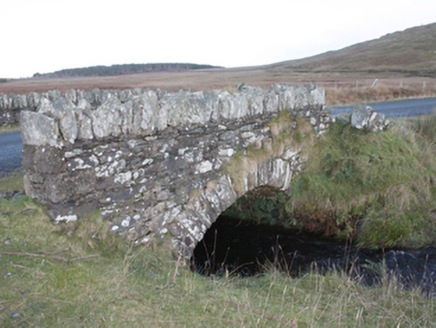 Strath BridgeBridge · 1.3 mi
Explorer Tom Strath Bridge spans the Meenatomish River in one round arch from around 1850. It may have been part of Famine relief work; the record notes that it is absent from an 1837 map. I can count the arch, but the bridge’s reason for being built is still a possibility.
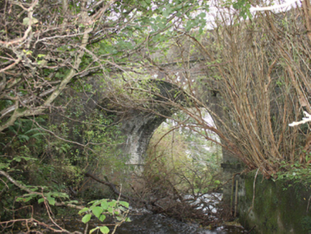 Drumskellan BridgeBridge · 2.7 mi
Explorer Tom Drumskellan Bridge was built around 1800 with one round arch over a small stream. The bridge keeps the road level, and an 1837 map shows old tuck and flax mills downstream. I thought the water was a minor character; the old map gives it two jobs.
 Eskaheen Portal TombPortal tomb · 2.8 mi
Explorer Tom Eskaheen Portal Tomb carries an enormous five-metre roofstone above its chamber. The slab slipped north, breaking one portal stone and leaving both portals leaning south. Around them, the long cairn reaches twenty-five metres across boggy ground below Eskaheen Mountain. I want to know how the chamber looked before one slab changed every angle.
 Eskaheen GraveyardGraveyard · 2.9 mi
Explorer Tom Eskaheen Graveyard lies on high ground looking over Lough Foyle. The earlier survey recorded part of the old church's west gable and a small south wall section, with an opening that might have been a door or window. I want to leave that uncertainty in: 4.4 metres of stone can tell us plenty, but cannot name every missing part.
 Muff ForestWoodland walk · 3.5 mi
Explorer Tom Muff Forest's Grania's Gap Loop climbs from Lisnagra Woods to views over Lough Foyle. Sport Ireland marks 6.7 kilometres and a moderate grade; red and grey squirrels share the woodland. Quite a lot of company for one loop.
 Scalp MountainMountain / peak · 3.9 mi
Explorer Tom Scalp Mountain in County Donegal is recorded as a peak that definitely keeps its hair on. I imagine it’s got a bit of a grumpy look, standing there with that whole view captioned and ready to judge your hiking boots.
 Quigley's PointHeadland · 4.2 mi
Explorer Tom Near Quigley's Point, United States Navy seaplanes flew from a Lough Foyle base in 1918. It closed by February 1919, after crews had built roads, hangars and slipways; quite a lot of building for such a short stay.
 Squealin' PigPub · 4.4 mi
Explorer Tom Squealin' Pig is hogging the main road so badly the pigs are squealing at the traffic. The next village claims they invented the squeal, but I doubt it. Go have a dramatic phone call from the pavement!
 Slieve MainMountain / peak · 4.4 mi
Explorer Tom Slieve Main is recorded as a mountain / peak in County Donegal, and it looks like a solid, reliable sort of hill. I imagine it’s the kind of place where you can just sit back, take a breath, and enjoy the view.
 FinnegansPub · 4.4 mi
Explorer Tom Finnegans sits right next to Squealin' Pig on the main road, sharing the spotlight like stubborn toddlers. Pick one and commit, or you'll get lost in the gossip. Have a wander and a wonder over there.
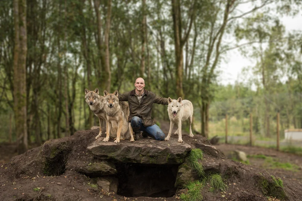 Wild IrelandWildlife sanctuary and family attraction · 5.7 mi
Explorer Tom Wild Ireland in County Donegal has animals who are way more interesting than most humans. The deer look at you like you stole their lunch, which you probably did. Bring the dog, it'll have opinions on the hierarchy.
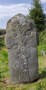 Cross in Glebe (fahan Ed)Cross · 7.3 mi
Explorer Tom Cross in Glebe is a slab that’s been arguing with scholars for centuries. It has two figures standing on either side of the cross, and their clothing is covered in inscriptions nobody can properly decipher yet. Add the Greek doxology carved down the edge, and it feels like a puzzle box from another world.
More mountains and hills in County Donegal · All of County Donegal

What do you know about this place?Tap to add a comment or ask a question