What is recorded here
From OpenStreetMap (© OpenStreetMap contributors) n12290667053
Places near here
Photo credits
- National Inventory of Architectural Heritage
- John Aidan Cawley, Geograph · Creative Commons Attribution-ShareAlike 2.0
- N Chadwick, Geograph · CC BY-SA 2.0
- Andreas F. Borchert, Wikimedia Commons · CC BY-SA 4.0
- Kenneth Allen, Geograph · CC BY-SA 2.0
- Kenneth Allen, Wikimedia Commons · CC BY-SA 2.0
- Michael Dibb, Wikimedia Commons · CC BY-SA 2.0
- michael clarke stuff, Wikimedia Commons · CC BY-SA 2.0
- Willie Duffin, Geograph · CC BY-SA 2.0
- Corinna Schleiffer, Geograph · CC BY-SA 2.0
 farm house1.1 mi
Explorer Tom Farm house in Carrowmore replaced an older home from 1837, settling into its role around 1880. It’s got a proper breakfront porch and retains those sharp timber sash windows, making it look far more dignified than your average barn-styled abode.
 St. Patrick's Catholic ChurchChurch/chapel · 1.8 mi
Explorer Tom Don't let the plain outside fool you, because inside this Templemoyle chapel hides a real surprise with its marble altar and stained glass. It’s been a proper community anchor since the 1850s, sitting right on that corner like a faithful old friend.

 E. McCleanRestaurant · 2.2 mi
Explorer Tom E. McClean is a great restaurant now, with lunch or dinner worth turning up for. Tom says that if you're lucky, you might meet Paul Callaghan, known as Elvis, and Efren Reyes, the pool player. He's bringing an appetite and keeping an eye out.
 Donowen Promontory FortPromontory fort, coastal · 2.7 mi
Explorer Tom Donowen Promontory Fort hides shapeless stone mounds that might be the ghost of a 16th-century O'Doherty castle. That’s a wild, salty possibility right there on the cliff edge. That rubble could be a fragment of a forgotten nobleman’s drama.
 CastleCastle, unclassified · 2.7 mi
Explorer Tom Castle in Carthage may survive only as shapeless stone mounds on a promontory. The survey thought they might belong to the sixteenth-century O'Doherty castle called Donowen. A wall closed the landward side, while another guarded a sea approach. Those defences are recorded; the exact shape of the lost castle is not.
 Iron Age Promontory FortArchaeological place · 2.7 mi
Explorer Tom Iron Age Promontory Fort is perched right over that wild stretch of Girt Bay. I can hear the waves arguing about who owns the rocks down there. It looks like a dragon’s jaw snapping at the tide.
 Culdaff ArmsPub · 2.9 mi
Explorer Tom Culdaff Arms is definitely where you go if your arm hurts from carrying too many bags. The name suggests heavy lifting or perhaps just tiredness. Stretch out those shoulders!
 CuldaffOfficial bathing water · 3.2 mi
Explorer Tom Culdaff Beach looks as if three pieces of the map agreed to meet for tea: dunes to the west, two rock outcrops to the southeast, and the Culdaff River to the northwest. The sand has quite a supporting cast. This protected coast deserves a gentle visit.
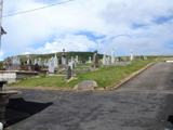 Lag GraveyardGraveyard · 4.2 mi
Explorer Tom Lag Graveyard lies in a natural enclosure of sandhills north of the Trawbreaga Bay channel. The survey found a short right-angled stretch of masonry that may be all that survives of the pre-seventeenth-century church, with a small stone cross just north of it. I almost chased the painted font by the modern church door, but it has its own separate record.
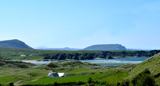 Five Finger StrandBeach / strand · 4.6 mi
Explorer Tom Five Finger Strand near Malin features rocky fingers reaching into the surf, backed by huge dunes that feel wild.
 Doagh Famine VillageMuseum · 4.6 mi
Explorer Tom Doagh Famine Village tells this coast's history through homes, voices and a guided tour. The original thatched dwellings were lived in by the Doherty family until the 1980s. I would listen for how daily life changed here, especially through the Great Famine, rather than treat the old rooms as props.
 Dough Famine VillageHeritage attraction · 4.6 mi
Explorer Tom Dough Famine Village jumps straight from the 1970s back to the 1840s. I suspect the timeline took a very short cut to get there. It feels like a museum that skipped a few centuries just to save space.
More mountains and hills in County Donegal · All of County Donegal

What do you know about this place?Tap to add a comment or ask a question