What is recorded here
From OpenStreetMap (© OpenStreetMap contributors) n9199393511
Places near here
Picture notes
- Wikimedia Commons contributor shown on the public file page · Public domain
- National Inventory of Architectural Heritage
- louise price, Wikimedia Commons · CC BY-SA 2.0
- D Gore, Geograph · CC BY-SA 2.0
- Kenneth Allen, Geograph · CC BY-SA 2.0
- Computer-made picture. It does not show this playground.
- Andreas F. Borchert, Wikimedia Commons · CC BY-SA 3.0 de
 BarnesmoreMountain / peak · 87 yd
Explorer Tom Barnesmore has been carrying the wrong name tag. Mountaineering Ireland calls this summit Croaghonagh and says Barnesmore belongs to the gorge below. I would ask the mountain to swap labels with the road, but it has stood its ground longer than my map has.
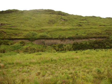 viaduct, bridge, embankment1.2 mi
Explorer Tom Viaduct, Bridge, Embankment in Keadew Upper marks the old railway route into the Barnesmore Gap. The line opened towards Donegal Town in 1889 and later changed gauge; that plain stone bridge kept its place after trains stopped in 1960.
 Old BarracksBarracks · 2.0 mi
Explorer Tom Old Barracks was built to guard Barnesmore Gap from highwaymen and brigands. It’s just fragmentary remains now, but imagine the Red Coats keeping watch there! I bet you could hear the echoes of history in the wind.
 CroaghnageerMountain / peak · 2.6 mi
Explorer Tom Here is Croaghnageer, with a whole view captured just for you in County Donegal, looking rather splendidly mysterious.
 The Ring, Leghawny Stone EnclosureEnclosure · 4.1 mi
Explorer Tom The Ring, Leghawny Stone Enclosure is soaked through and hides a seat-like stone structure called 'the Chair'. It’s not exactly comfortable, but it’s the perfect spot to watch the rain come down on Clogher Hill in absolute solitude.
 Ard na Mona WoodOfficial walking route · 4.6 mi
Explorer Tom Ard na Mona Wood is a 1.9 km loop in County Donegal, taking you through rare ancient oak woodland near Lough Eske.
 Harvey’s PointHotel · 4.7 mi
Explorer Tom Harvey’s Point Hotel has manicured lawns running down to the water, which sounds like a slippery slope. A Swiss family started it all! Wave to the lake for me, you gorgeous.
 Drumrooske East RingfortFairy fort / earthen ringfort · 7.1 mi
Explorer Tom Drumrooske East Ringfort is a large circular area with a substantial earthen bank up to two metres high, deliberately taller on the west side. The interior has been disturbed recently, with straw rick foundations cut into the northwest bank. It sits on a drumlin summit overlooking Donegal Bay, with boggy valleys around it.
 Teach Tábhairne an RileánPub · 7.3 mi
Explorer Tom Teach Tábhairne an Rileán in County Donegal has a mouthful of a name. Say it three times fast for me and tell me how you feel!
 Donegal Railway Heritage CentreMuseum · 7.8 mi
Explorer Tom Donegal Railway Heritage Centre keeps the county's railway stories in an old station house, including the 1907 Drumboe engine and an interactive cab. I would begin with the engine, then try the cab to see what a driver watched. At last, a railway stop where I am allowed to stay awhile.
 Michael Cooney Memorial ParkChildren's playground · 7.8 miComputer-made picture. It does not show this playground.
Explorer Tom Michael Cooney Memorial Park in County Donegal sounds like a guy who really loved his own name. Maybe he turned into a giant slide before dying? Check for ghostly playground equipment, please.
 Station IslandIsland · 8.0 mi
Explorer Tom Station Island is the Lough Derg pilgrimage island; the older monastery island is its neighbour, Saints Island. The traditional pilgrimage lasts three days. I would want the current dates and a proper booking sorted before I packed, because a lake crossing deserves more planning than my usual wandering.
More mountains and hills in County Donegal · All of County Donegal

What do you know about this place?Tap to add a comment or ask a question