What is recorded here
Monument described by Victor Buckley in 1982 as a small crannóg (approx. dims. 14m E-W; 13m N-S) on the NW shore of McEvoy’s Lough which rises (H 0.8-0.9m) above the surrounding boggy ground. It is situated approx. 10m to N of the present lake edge and approx. 18m to S of the original shoreline. Slight traces of a causeway to the N may be 19th century. There are two Oak (Quercus) timbers from the palisade visible on the S edge of the crannog: One is 30cm in diameter and stands 40cm above the ground and the other is 20cm in diameter and only protrudes slightly. There is evidence of disturbance within the interior derived from tree roots in the W quadrant and by the construction of a pump house in the E quadrant, sometime during the later 19th century. The pump itself has been sunk into the centre of the crannog. Described by O'Sullivan (2004, 112-3) as 'Located on northwest shore of McEvoy’s Lough, a small lake associated with the larger lakes, Lough Drin and Slevin’s Lough to east and south. This crannog is a circular mound (dims. 13m N-S x 14m E-W; H 0.9m) of earth, located in marshy ground about 18m from original shore (10m from present shore) at northwest end of McEvoy’s Lough. The mound is overgrown and has an irregular surface, with a possible causeway leading towards the dryland to the north. There is a possible palisade on the southern edge, represented by two substantial wooden posts (20-30cm diameter) facing outwards towards the lake. The site was disturbed by the building on it of a 19th century pump-house.'
Compiled by: Caimin O'Brien based on details provided by Aidan O'Sullivan.
Monument described by Victor Buckley in 1982 as a small crannóg (approx. dims. 14m E-W; 13m N-S) on the NW shore of McEvoy’s Lough which rises (H 0.8-0.9m) above the surrounding boggy ground. It is situated approx. 10m to N of the present lake edge and approx. 18m to S of the original shoreline. Slight traces of a causeway to the N may be 19th century. There are two Oak (Quercus) timbers from the palisade visible…
From the National Monuments Service (Archaeological Survey of Ireland) record WM019-012
The monument record does not grant public access. Check the route and ask the landowner before entering private land.
- What survives
- Recorded monument
Places near here
Photo credits
- Mike Searle, Geograph · Creative Commons Attribution-ShareAlike 2.0
- National Inventory of Architectural Heritage
- fr:Gavigan:Knockdrin_a.jpg/Knockdrin_a.jpg, Wikimedia Commons · GFDL
- Bridget Neville, Wikimedia Commons · CC BY-SA 4.0
- kevin higgins, Geograph · CC BY-SA 2.0
OutlinedFairy fort / earthen ringfort · 810 yd Knockdrin CastleGate lodge · 977 ydLong PlantingForest · 1201 ydIndicatedCastle, tower house · 1223 ydBallynagallDemesne walls/gates/railings · 1559 ydKnockdrin CastleCastle · 1.1 miPartially hachuredFairy fort / ringfort · 1.2 miSaint Brigid's WellSpring · 1.4 miUnited Nations War MemorialMemorial · 1.8 miLady's IslandWood · 2.0 miChurch IslandIsland · 2.1 miSrudarra IslandIslet · 2.7 mi
 Knockdrin CastleGate lodge · 977 ydLong PlantingForest · 1201 ydIndicatedCastle, tower house · 1223 yd
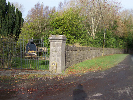 BallynagallDemesne walls/gates/railings · 1559 yd
 Knockdrin CastleCastle · 1.1 miPartially hachuredFairy fort / ringfort · 1.2 mi
 Saint Brigid's WellSpring · 1.4 miUnited Nations War MemorialMemorial · 1.8 miLady's IslandWood · 2.0 mi
 Church IslandIsland · 2.1 miSrudarra IslandIslet · 2.7 mi
More archaeology and monuments in County Westmeath · All of County Westmeath
What do you know about this place?