What is recorded here
Brockagh Castle situated on a low natural hill which forms part of a long N-S ridge, in undulating grassland, with good views in all directions. Rectangular building aligned NE-SW depicted as an upstanding structure on 1837 ed. OS 6-inch map. On the revised 1911 ed. OS 25-inch map only the SW gable is shown as standing in the centre of sub-circular shaped enclosure (CUCAP BGH102) which is not depicted on the 1837 ed. OS 6-inch map. The ruins of a rectangular structure (approx. dims. 11m E-W x 7m N-S) aligned on a NE-SW axis built of roughly dressed mortared limestone, with a slight base batter standing in the centre of a sub-circular shaped enclosure (WM012-173001-). Only the SW wall survives upstanding (approx. H 3m) and has a single window in the centre of the wall. Elsewhere the outline of the castle is visible as low grass covered wall footings. The corners of the castle are rounded in a similar fashion to Carrick Castle (WM011-012----). The terrier of the 1655-9 Down Survey map of Mullingar parish listed Andrew Tuite as the owner of the lands of Brockagh in 1641 (NLI, MS 723-4).
Brockagh Castle situated on a low natural hill which forms part of a long N-S ridge, in undulating grassland, with good views in all directions. Rectangular building aligned NE-SW depicted as an upstanding structure on 1837 ed. OS 6-inch map. On the revised 1911 ed. OS 25-inch map only the SW gable is shown as standing in the centre of sub-circular shaped enclosure (CUCAP BGH102) which is not depicted on the 1837…
From the National Monuments Service (Archaeological Survey of Ireland) record WM012-173
The monument record does not grant public access. Check the route and ask the landowner before entering private land.
- What survives
- Recorded monument
Places near here
Photo credits
- Mike Searle, Geograph · Creative Commons Attribution-ShareAlike 2.0
- National Inventory of Architectural Heritage
- fr:Gavigan:Knockdrin_a.jpg/Knockdrin_a.jpg, Wikimedia Commons · GFDL
- Bridget Neville, Wikimedia Commons · CC BY-SA 4.0
- kevin higgins, Geograph · CC BY-SA 2.0
- Mike Searle, Geograph · CC BY-SA 2.0
Long PlantingForest · 543 ydOutlinedFairy fort / earthen ringfort · 706 yd Knockdrin CastleGate lodge · 954 ydBallynagallDemesne walls/gates/railings · 1075 ydPartially hachuredFairy fort / ringfort · 1091 ydKnockdrin CastleCastle · 1.0 miSaint Brigid's WellSpring · 1.3 miScragh Bog Nature ReserveNature reserve · 1.4 miChurch IslandIsland · 1.5 miUnited Nations War MemorialMemorial · 2.0 miSrudarra IslandIslet · 2.2 miCarrick CastleCastle · 5.8 mi
 Knockdrin CastleGate lodge · 954 yd
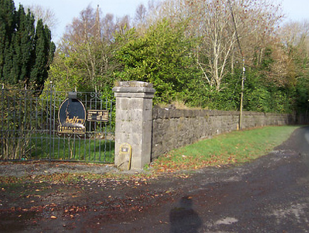 BallynagallDemesne walls/gates/railings · 1075 ydPartially hachuredFairy fort / ringfort · 1091 yd
 Knockdrin CastleCastle · 1.0 mi
 Saint Brigid's WellSpring · 1.3 miScragh Bog Nature ReserveNature reserve · 1.4 mi
 Church IslandIsland · 1.5 miUnited Nations War MemorialMemorial · 2.0 miSrudarra IslandIslet · 2.2 mi
 Carrick CastleCastle · 5.8 mi
More castles and forts in County Westmeath · All of County Westmeath
What do you know about this place?