Places near here
Photo credits
- National Inventory of Architectural Heritage
- Sarah777, Geograph · CC BY-SA 2.0
- Brenkin, Wikimedia Commons · Public domain
- Patrick Keegan, Wikimedia Commons · CC BY 4.0
- Dwxn, Wikimedia Commons · CC BY-SA 4.0
- Mike Searle, Wikimedia Commons · CC BY-SA 2.0
- Lord Monkstown ( talk ), Wikimedia Commons · Public domain
- Joan and Max Wellman, Geograph · Creative Commons Attribution-ShareAlike 2.0
- Wanfried-Dublin, Wikimedia Commons · CC BY-SA 4.0
- Eric Jones, Geograph · CC BY-SA 2.0
- Superchilum, Wikimedia Commons · CC BY-SA 4.0
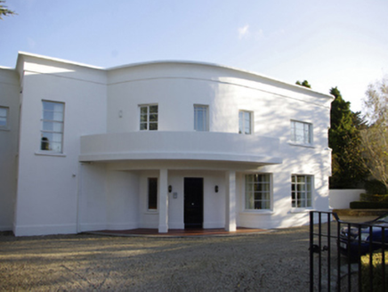 GlencroeHouse · 33 yd
Explorer Tom Glencroe in Galloping Green South is a mid-century modern house that looks like it walked straight out of a sci-fi movie from the 1960s. It’s got this curved plan and a loggia that makes it look very expensive. Find a local who knows where to park, because those curves are tricky for novices.
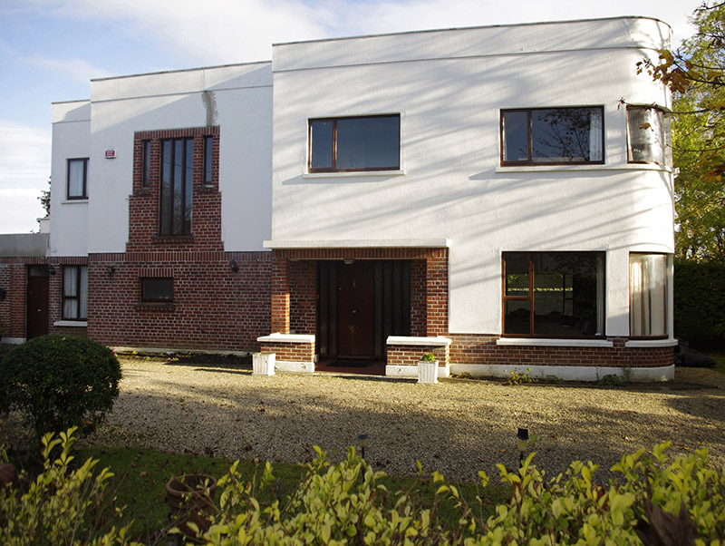 RibbadeneHouse · 35 yd
Explorer Tom Ribbadene in Galloping Green South ended up here because its architect got drunk and pointed at the wrong field while planning the estate. It’s a mid-twentieth-century red brick house that thinks it’s way too cool to be in a suburb called 'Galloping'. Just wave from the road; it’s probably napping inside its staggered plan.
 Foxrock Village Heritage MapVisitor information · 960 yd
Explorer Tom Foxrock Village Heritage Map in County Dublin is feuding with the next village over because they claim our map shows their pub as a 'suspiciously small outhouse.' It’s a daft argument, but it’s keeping the local gossip mill running at full speed all year round. Bring the dog, it’ll have opinions.
 Stillorgan ObeliskMonument · 1474 yd
Explorer Tom Stillorgan Obelisk would order extra vinegar and no ketchup in a chipper, because it has standards and doesn’t want to mix things up. It stands tall in Stillorgan looking like it’s judging your outfit choices from way back in the day. Bring a jacket, it's never as warm as I promise.
 Proclamation of the Irish RepublicMemorial · 1.4 mi
Explorer Tom Proclamation of the Irish Republic is a big deal in County Dublin. It’s a memorial to history changing. The picture looks nice from a distance. Get closer and listen to the echoes of old speeches.
 Castle (in ruins)Castle, tower house · 1.6 mi
Explorer Tom Castle in Monkstown Castlefarm has had so many names that it probably gets confused about who it is when you ask it to spell its surname. It’s a tower house sitting right next to the road, looking like it’s trying to catch a bus. Have a wander and a wonder.
 Bawn in Monkstown CastlefarmBawn · 1.6 mi
Explorer Tom Monkstown Bawn is an L-shaped wall that used to protect monks from people who wanted their grain. Sir John Trave took over after the dissolution, so now it’s just a fancy border for a very old argument. Visit, then text me what you think. I'll pretend to read it and nod sagely.
 Monkstown CastleHeritage attraction · 1.6 mi
Explorer Tom Monkstown Castle in County Dublin is viewing itself from the east, apparently. It's a heritage attraction, so it must have some stories to tell. Peek over the walls and see what secrets are hiding there!
 Graveyard in Monkstown HousefarmGraveyard · 1.6 mi
Explorer Tom Graveyard in Monkstown Housefarm is a trapezoidal walled site with a pointed arched gateway. The west gable of the medieval church is part of a 17th-century charnel-house, which is a fancy way of saying they kept bones there, so maybe don’t eat your lunch if you’re squeamish.
 Glendruid DolmenArchaeological place · 1.7 mi
Explorer Tom Glendruid Dolmen is an ancient stone table where a priest lost a bet involving a goat and a very bad haircut. It’s been sitting there for five thousand years, looking like it’s waiting for someone to pay up on that wager. Tell me if the gossip I made up is true.
 SeapointBeach / strand · 1.8 mi
Explorer Tom Seapoint in County Dublin has rocks and buoys that stop motorboats from getting too close to you. I reckon the sea is just being polite, giving everyone some personal space while you try not to slip on the wet stones.
 Oriental plane2.4 mi
Explorer Tom Oriental plane in County Dublin is so big that map makers have been getting it wrong for years, mostly because they keep thinking it’s two separate trees. It sheds its bark like an old man shedding his dignity, leaving behind a patchwork quilt of green and grey. Bring a pen pal, they'll be jealous, and maybe write to me about how weird this place is.
More historic places in County Dublin · All of County Dublin

What do you know about this place?Tap to add a comment or ask a question