
What is recorded here
Situated to the SE of the junction of Monkstown Avenue and Mounttown Road Upper the site is located in grassland on the road edge. A bawn wall is built of coursed granite blocks. Remaining section is L shaped (SE-NW c. 26m; SW- NE c. 17.5m). The site was associated with the Cistercian grange of St Mary's Abbey. After the dissolution in the sixteenth century the lands at Monkstown were given to Sir John Travers, Master of the Ordnance of Ireland. Walter Cheevers had it in 1641, then Ludlow Cromwell, Master of the House, who is said to have repaired the castle and laid out the gardens (Ball 1906, I, 1-12). A drawing by Beranger dated 1766 shows two towers placed either end of a courtyard flanked by a multi-chimneyed mansion on the one side and a show wall on the other (Harbison 1998, 60-1). The bawn wall (DU023-014003-) connects a tower house (DU023-014001-) and gatehouse (DU023-014002-).
Situated to the SE of the junction of Monkstown Avenue and Mounttown Road Upper the site is located in grassland on the road edge. A bawn wall is built of coursed granite blocks. Remaining section is L shaped (SE-NW c. 26m; SW- NE c. 17.5m). The site was associated with the Cistercian grange of St Mary's Abbey. After the dissolution in the sixteenth century the lands at Monkstown were given to Sir John Travers,…
From the National Monuments Service (Archaeological Survey of Ireland) record DU023-014003
The monument record does not grant public access. Check the route and ask the landowner before entering private land.
- What survives
- Recorded monument
Places near here
 Monkstown CastleHeritage attraction · 8 yd
 Castle (in ruins)Castle, tower house · 9 yd
 Church in Monkstown HousefarmChurch · 110 yd
 Graveyard in Monkstown HousefarmGraveyard · 120 yd
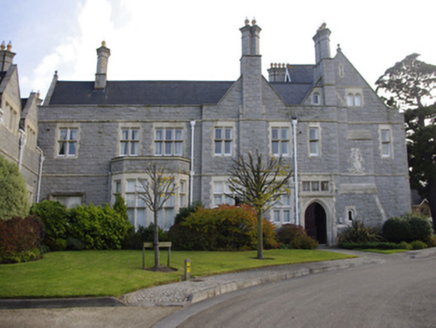 RockfordCountry house · 928 ydNature TrailVisitor information · 971 yd
 SeapointBeach / strand · 1160 yd
 Grange ChurchEcclesiastical site · 1179 ydDlr TourismVisitor information · 1403 ydChrist the KingMemorial · 1420 yd
 National Maritime Museum of IrelandMuseum · 1423 yd
 King George IV MonumentMonument · 1487 yd
Pictures: Lord Monkstown ( talk ), Wikimedia Commons · Public domain; Dwxn, Wikimedia Commons · CC BY-SA 4.0; Joan and Max Wellman, Geograph · CC BY-SA 2.0; Joan and Max Wellman, Geograph · Creative Commons Attribution-ShareAlike 2.0; National Inventory of Architectural Heritage; Eric Jones, Geograph · CC BY-SA 2.0; Kania1966, Wikimedia Commons · CC BY-SA 4.0; Hohenloh, Wikimedia Commons · CC BY-SA 3.0; Gareth James, Geograph · CC BY-SA 2.0
More castles and forts in County Dublin · All of County Dublin
What do you know about this place?