What is recorded here
Map note: The map marks Corry's Crag as a viewpoint in County Down, Ireland. Bring your curiosity; check the map before chasing the horizon.
Corry's Crag is recorded as a viewpoint in County Down.
From OpenStreetMap (© OpenStreetMap contributors) n1806941870
Places near here
Photo credits
- Eric Jones, Geograph · CC BY-SA 2.0
- Albert Bridge, Geograph · CC BY-SA 2.0
- Northern Ireland Office, Wikimedia Commons · CC BY 2.0
- Rossographer, Wikimedia Commons · CC BY-SA 2.0
- Rossographer, Geograph · CC BY-SA 2.0
- thejackrustles, Geograph · CC BY-SA 2.0
- Elkay62, Wikimedia Commons · CC BY-SA 4.0
- N Chadwick, Geograph · CC BY-SA 2.0
- MartinRobinson at English Wikipedia, Wikimedia Commons · CC BY-SA 3.0
 Lead MineLead mine, Chimney of South Engine House (ihr site, c.f. ihr 2633:1 for details) · 209 yd
Explorer Tom Another Lead Mine chimney in Whitespots, this one belonging to the South Engine House. It’s basically a giant stone finger pointing at nothing in particular. Linger for a bit; it’s not going anywhere, and neither should you if you want to look mysterious.
 Windmill StumpRuins · 357 yd
 Somme Heritage CentreMuseum · 821 yd
 Helen's TowerTower · 1157 yd
Explorer Tom Helen's Tower in Conlig is a Grade A listed tower from the 1840s. It would tell its younger self to stop worrying about the roof. Take a mate and argue about what it was actually for all day.
 Blair Mayne statueMonument · 1.4 mi
 Kiltonga Nature ReserveNature reserve · 1.5 mi
 CairngaverMountain / peak · 2.3 mi
 Scrabo TowerHeritage attraction · 2.4 mi
 Scrabo HillMountain / peak · 2.4 mi
 Kilcooley WoodWood · 2.5 mi
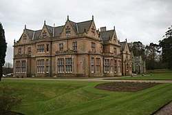 Bangor CastleCastle · 3.1 mi
 North Down Coastal PathWalking route · 3.3 mi
More viewpoints and information in County Down · All of County Down

What do you know about this place?Tap to add a comment or ask a question