
What is recorded here
Windmill Stump is recorded as a ruins in County Down.
From OpenStreetMap (© OpenStreetMap contributors) n1200500500
Places near here
 Lead MineLead mine, Windmill stump (c.f. ihr 2633:2 for details) · 2 yd
 Lead MineLead mine, Chimney of South Engine House (ihr site, c.f. ihr 2633:1 for details) · 231 yd
.png/250px-Secretary_of_State_visits_the_Somme_Heritage_Centre_in_Newtownards._(45119406404).png "Photo: Northern Ireland Office, Wikimedia Commons · CC BY 2.0") Somme Heritage CentreMuseum · 479 yd
Somme Heritage CentreMuseum · 479 yd Helen's TowerTower · 1096 ydHelen's TowerMonument · 1097 yd
 Kiltonga Nature ReserveNature reserve · 1.7 mi
 CairngaverMountain / peak · 2.4 mi
 Kilcooley WoodWood · 2.5 mi
 Scrabo TowerHeritage attraction · 2.6 mi
 Scrabo HillMountain / peak · 2.6 mi
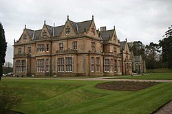 Bangor CastleCastle · 3.0 mi
 North Down Coastal PathWalking route · 3.3 mi
Pictures: Eric Jones, Geograph · CC BY-SA 2.0; Northern Ireland Office, Wikimedia Commons · CC BY 2.0; Rossographer, Wikimedia Commons · CC BY-SA 2.0; Ross, Wikimedia Commons · CC BY-SA 2.0; Albert Bridge, Geograph · CC BY-SA 2.0; thejackrustles, Geograph · CC BY-SA 2.0; Elkay62, Wikimedia Commons · CC BY-SA 4.0; N Chadwick, Geograph · CC BY-SA 2.0; MartinRobinson at English Wikipedia, Wikimedia Commons · CC BY-SA 3.0; Rossographer, Geograph · CC BY-SA 2.0
More historic places in County Down · All of County Down
What do you know about this place?