Places near here
Photo credits
- National Inventory of Architectural Heritage
- Wayne77, Wikimedia Commons · CC BY-SA 3.0
- Kmcnamee, Wikimedia Commons · CC BY-SA 4.0
- Mike Searle, Geograph · CC BY-SA 2.0
- Kieran Campbell, Wikimedia Commons · CC BY-SA 2.0
Explorer Tom Enclosure in Raheen hosted a dance that went so far that the floor is still shaking from the bass. It's huge, marshy…
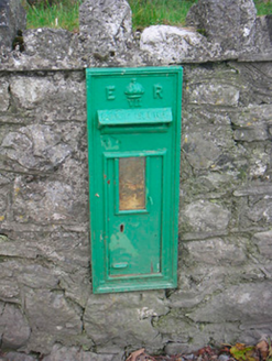 post box1464 yd
Explorer Tom Post box in Ballinlig Upper is stuck in a bit of a tiff over who owns the best view from that little green square. It’s…
 Saint Owen's RectoryRectory/glebe/vicarage/curate's house · 1490 yd
Explorer Tom Saint Owen's Rectory in Glebe is suspicious of the postman because he’s always late with the church newsletters. It’s…
Enclosure in ClonybaneEnclosure · 1730 ydExplorer Tom Enclosure in Clonybane is suspicious of the postman because he keeps delivering bills for rent that hasn’t been paid…
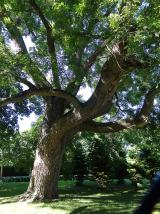 Japanese pagoda tree2.2 mi
Explorer Tom Japanese pagoda tree in County Westmeath was once ruled by a goat who decided it had the best view of the grazing land…
KnockastiaMountain / peak · 2.7 miExplorer Tom Knockastia would post a selfie with the caption 'Living my best rock life' and get zero likes from the clouds. It’s…
 Rosemount GAAGAA ground · 3.1 miSam's ParkForest · 3.4 mi
Explorer Tom Sam’s Park is exactly what Saint Patrick would have called a 'nice bit of green' before he got distracted by the frogs.…
Maryland GAA pitchGAA ground · 3.5 mi Laragh CastleCastle · 4.3 mi
Explorer Tom Laragh Castle is a McGeoghan tower standing next to a public road, judging every car that drives past with its…
 CastleCastle, motte and bailey · 4.9 mi
Explorer Tom Dunnamona's motte is in a bitter feud with the next village over about who invented the perfect way to eat potatoes…
Dún na Sí Heritage CentreMuseum · 5.0 miExplorer Tom Dún na Sí in Moate puts a farmhouse, a forge and a reconstructed ringfort within one heritage park; that is a lively…
More historic places in County Westmeath · All of County Westmeath

What do you know about this place?Tap to add a comment or ask a question