
What is recorded here
On S bank of River Blackwater, at E end of Fermoy. Ruins of large mill complex comprising of 3- and 5-storey buildings arranged around a yard. Complex partly destroyed by fire (FFIAS, 15) and subsequently rebuilt. Millrace taken from river by weir just W of Fermoy Bridge (14806); part of millrace diverted to feed Paper Mill (no longer survives) to E. L-shaped 5-storey corn mill (long axis N-S; leg on S end of E side) on NW side of complex; stone-arched window opes, upper opes repaired with brick arches; interior empty shell. Wheel-pit inside W end of N wall, contains poncelot waterwheel (diam. c. 6.5m; Wth 1.4m): cast-iron axle; three rim-segments; cast-iron arms; curving wrought iron 'starts' with remains of wooden paddles. Wheel powered pit-wheel which in turn powered line shafts of original mill and subsequently line shaft into addition to N. Mill extended to N by 6-bay, 5-storey addition (shown on 1842 OS 6-inch map): stone-arched window opes, upper arches repaired with brick, probably at same time as those on earlier mill. Waterwheel housed in enclosed wheel-pit within S end of extension, adjacent to wheel-pit of original mill. Contains poncelot suspension waterwheel (diam. 8m; Wth 2.4m): cast-iron axle; four rim segments; cast-iron arms; curved wrought-iron starts with remains of wooden paddles. Pinion wheel transfers power to mill. Much of ground-floor line shafts remain in both parts of mill.
Three-storey square grain-drying kiln (int.: 6.25m E-W; 6.35m N-S) in NE corner of complex. This has pyramidal slate roof with central roof vent and houses an early 20th-century vertical grain-drying kiln, with a brick furnace in NE corner. East range of complex composed of offices and stores with 3-storey residential house at S end.
Built by Mr D. Reid in 1802, it was one of largest corn mills in country, manufacturing 12-15,000 barrels of flour annually (Bunyan 1980, 16; Bielenberg 1991, 43).
Most of complex demolished subsequent to site inspection and one waterwheel removed; corn mill in NW corner has been rebuilt as office block.
The above description is derived from the published 'Archaeological Inventory of County Cork. Volume 4: North Cork' (Dublin: Stationery Office, 2000). In certain instances the entries have been revised and updated in the light of recent research.
Date of upload/revision: 14 January 2009
The monument record does not grant public access. Check the route and ask the landowner before entering private land.
- What survives
- Recorded monument
Places near here
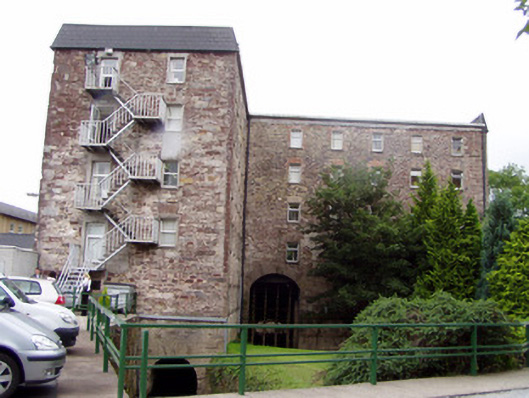 mill (water)mill (water) · 26 yd
 Glenavon Housegates/railings/walls · 165 yd
 Kent BridgeMemorial · 457 yd
 Tourist InformationVisitor information · 533 yd
 Burial GroundGraveyard · 610 yd
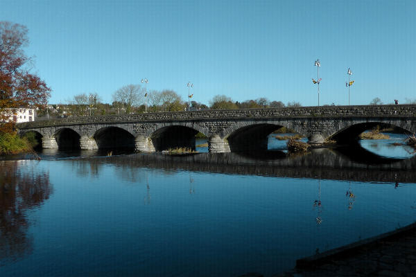 Fulacht fia in FermoyFulacht fia · 621 yd
 Graveyard in FermoyGraveyard · 646 yd
 Old Railway ViaductViewpoint · 1146 yd
 Carrigabrick Castle (in Ruins)Castle, tower house · 1198 yd
 Licklash Castle (in Ruins)Castle, hall-house · 1.1 mi
 Ballybrack WoodForest · 1.2 mi
 Strawhall WoodForest · 1.4 mi
Other information
Photo: Credit not shown in the picture search · Rights wording not checked; contact us if this picture should be removed