Places near here
Photo credits
- National Inventory of Architectural Heritage
- Neville Goodman, Geograph · CC BY-SA 2.0
- Xx78900, Wikimedia Commons · CC BY-SA 4.0
- Jonathan Thacker, Geograph · CC BY-SA 2.0
- Vadim Manuylov, Wikimedia Commons · CC BY-SA 3.0
- Neville Goodman, Wikimedia Commons · CC BY-SA 2.0
- Neville Goodman, Geograph · Creative Commons Attribution-ShareAlike 2.0
- Mike Searle, Wikimedia Commons · CC BY-SA 2.0
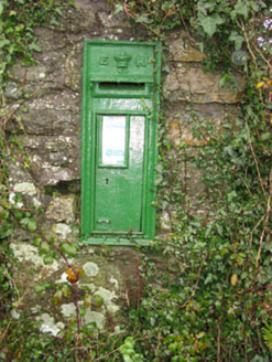 post box192 yd
Explorer Tom Post box in Brinny is sitting on a pier at a crossroads, judging your life choices. Edwardian crown on top, looking very royal and slightly damp. Count the crows, then ask them if they’ve seen a stamp.
 Church in BrinnyChurch · 240 yd
Explorer Tom Church in Brinny was rebuilt in the 1730s because it wanted a fresh start. It would bring a six-pack to any party. Make up your own legend and I'll swear it's true.
 Brinny Church of Ireland ChurchChurch/chapel · 241 yd
Explorer Tom Brinny Church of Ireland Church is dressed up for a party that ended in 1890. It’s got a tower that Henry Hill built to show off, like a giant stone finger. Ring your grandad and ask him what the stained glass really means.
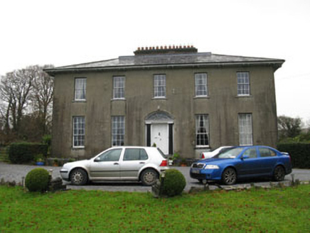 Brinny GlebeRectory/glebe/vicarage/curate's house · 563 yd
Explorer Tom Brinny Glebe was a rectory built around 1810, now just a private house with a hipped slate roof. It’s got that symmetrical early nineteenth-century look with timber sash windows that are doing their best not to let the rain in. The doorcase is the real star here.
Burial ground in Kilpatrick (kinalmeaky By.)Burial ground · 1018 ydExplorer Tom Burial ground in Kilpatrick is known as 'Tadg na Reilige', which sounds like a name I'd make up. No visible surface trace means it's all about the local tradition and vibes. Trust me, it's definitely there.
Roche's WoodWood · 1.4 miGraveyard in KilnagnadyGraveyard · 1.5 miExplorer Tom Graveyard in Kilnagnady is playing hard to get because it’s basically a field with a secret past. Fences are gone, ground’s flat, and the locals say it’s attached to a church that vanished like my motivation. Perfect detour when your GPS thinks you’re on the moon.
 Downdaniel Castle (in Ruins)Castle, tower house · 1.5 mi
Explorer Tom Downdaniel Castle in Ardnaclug sits on the bank of the Bandon River. Half of it is standing to four storeys, which is impressive for an old tower house. The walls are thinner on one side, weirdly enough!
 Monterey Cypress1.7 mi
Explorer Tom Monterey Cypress in County Cork was briefly ruled by a goat named Steve who ate half its leaves. Steve is long gone, but the trauma remains. Snap one photo, then put the phone away and actually look at it.
 Sunday WellSpring · 1.8 mi
 Kilpadder Burial Ground (Site of)Burial ground · 2.9 mi
Explorer Tom Kilpadder Burial Ground is hiding in the pasture so deep it refuses to fall down or get found. The overgrowth is basically doing a great job of keeping secrets. Bring a jacket, it's never as warm as I promise.
 Castlemore CastleCastle · 6.5 mi
Explorer Tom Castlemore Castle in County Cork is just a name on a map and a picture file. No details, no drama. Be cheeky and take a photo for me if you can find anything more than the words 'Castle More' in your head.
More historic places in County Cork · All of County Cork

What do you know about this place?Tap to add a comment or ask a question