Places near here
Photo credits
- National Inventory of Architectural Heritage
- Mike Searle, Wikimedia Commons · CC BY-SA 2.0
- Dylan Moore, Geograph · CC BY-SA 2.0
- Mike Searle, Geograph · CC BY-SA 2.0
- No machine-readable author provided. Christian1965~commonswiki assumed (based on copyright claims)., Wikimedia Commons · Public domain
- Colin Park, Geograph · CC BY-SA 2.0
- Hywel Williams, Geograph · Creative Commons Attribution-ShareAlike 2.0
- Sitomon, Wikimedia Commons · CC BY-SA 2.0
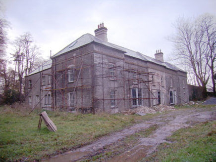 Baggotstown HouseCountry house · 743 yd
Explorer Tom Baggotstown House has had so many names it’s got identity crisis and won’t stop changing its mind about who it is. It’s all fancy neo-classical bits but secretly just wants a nap in the garden. Bri
 Ballyvulhane BridgeBridge · 805 yd
Explorer Tom Ballyvulhane Bridge in Ballyvulhane thinks Dublin tourists are all talk and no walking. Those round arches were rebuilt in 1922 because of a Civil War attack, which is fancy! Best enjoyed with a snack you bought from a van that smells like diesel.
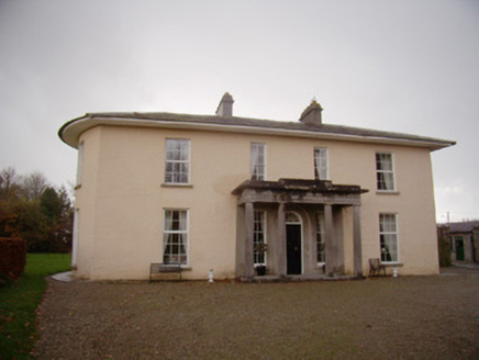 Milltown ParkCountry house · 1077 yd
Explorer Tom Milltown Park has seagulls that constantly rate its classical proportions and mostly give two stars. It was built by Charles Frederick Anderson, who clearly loved a good column. Give it a pat on the way past.
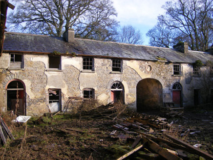 Kilballyowen HouseOutbuilding, stables · 1.3 mi
Explorer Tom Kilballyowen House nearly sold itself as a horse stable because the main house got demolished in the seventies. It's now just fancy stables with zero shame about its demesne past. Ring your granny a bell.
_-_geograph.org.uk_-_1541499.jpg/250px-Castles_of_Munster,_Ballygrennan,_Limerick_(2)_-_geograph.org.uk_-_1541499.jpg "Photo: Mike Searle, Wikimedia Commons · CC BY-SA 2.0") Ballygrennan Castle (in ruins)Bawn · 1.3 mi
Ballygrennan Castle (in ruins)Bawn · 1.3 miExplorer Tom Ballygrennan Castle bawn smells like old socks and wet dog, according to Tom, but he swears it’s just historical atmosphere. The circular staircase is particularly good at making you dizzy if you’re not careful. Go on a wet day, it suits the mood.
 KnockainyMountain / peak · 1.7 mi
Explorer Tom Knockainy swears by a local superstition that says if you whistle on top of it, you’ll find lost keys. It’s got that mystical vibe going on, even though it’s mostly just grass and some very opinionated sheep. Bring someone who'll believe anything.
 Castle (in ruins)Castle, tower house · 4.2 mi
Explorer Tom Fantstown Castle would describe itself to a stranger as 'slightly damp, historically significant, and currently unavailable'. It’s got a bit of an ego about its muddy foundation. Leave nothing but footprints and a bad pun.
 Áine and Gearóid Iarla: Lough GurLegend location · 4.2 mi
Explorer Tom Áine and Gearóid Iarla: Lough Gur has a goddess for the lake and a sleeping lord in the old stories. I thought I was coming to admire water and stones. Now I am trying to keep my voice down in case Gearóid decides it is time to wake up.
 SlievereaghMountain / peak · 7.3 mi
Explorer Tom Slievereagh has very strong opinions on modern buildings and has been muttering about them since 1890. It thinks that concrete is just rock that gave up on life too early. Ideal spot for a dramatic phone call.
 Grave YardGraveyard · 7.8 mi
Explorer Tom Graveyard in Ballingarry refuses to fall down because it’s holding onto its dignity with both hands and refusing to give an inch to decay. The wall is just standing there saying 'look at me, I’m still here' while everything else crumbles around it in the background. Best seen with a hangover and a sausage roll.
 Ladys WellHoly well · 9.0 mi
Explorer Tom Ladys Well in Ballylanders in Limerick is in a churchyard with statues of Our Lady, looking very dignified. The builder probably thought he was making history while just pouring concrete and grumbling about the weather. Bring your nan, she'll know more than me.
 European Yew24 mi
Explorer Tom European Yew here, planning retirement by just standing still for another five hundred years. It says it's saving up leaves for a big trip to the afterlife. Stick around for the light changing, it's a slow burn show.
More historic places in County Limerick · All of County Limerick

What do you know about this place?Tap to add a comment or ask a question