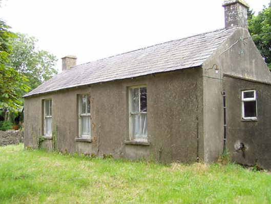
What is recorded here
Detached three-bay single-storey former school, built c. 1870, with single-bay single-storey lean-to extension/block attached to the east gable end. Now in disuse. Pitched natural slate roof having ashlar limestone chimneystack to either end with projecting string course. Smooth cement rendered walls. Square-headed window openings with two-over-two timber sliding sash windows having limestone sills. Square-headed opening to east face to lean-to block/extension having timber battened door. Set back from road in own grounds to the northwest of Edgeworthstown. Site bounded on three-sides by rubble stone boundary wall, cement rendered boundary wall to the east. Main entrance gates to the southeast of school, comprising a pair of rendered gate piers (on square-plan) having rendered caps and with a pair of wrought-iron gates having cast-iron decorative elements and finials.
This simple late nineteenth-century national school retains its early form and character. Its modest form is enhanced by the retention of original fabric such as the national slate roof, limestone sills and the timber sliding sash windows. The ashlar limestone chimneystacks are an unusual feature for a utilitarian building of this type. It is of social importance to the local community as one of the earliest school buildings still extant in the local area. The present building replaced an earlier school house at Corboy (Ordnance Survey first edition six-inch map 1838), which was located a short distance to the east at the far side of the approach avenue serving Corboy Presbyterian meeting house (13401440). The proximity of this school to this Presbyterian meeting house suggests that it may have been in use as a Presbyterian national school. This school building may have been built in 1871, when tenders were sought for the construction of a new national school at Corboy (Irish Architectural Archive), and it may have been constructed by a Thomas Gill. The simple wrought-and cast-iron gates, and the rubble stone boundary walls, complete the setting and add to this unassuming composition.
This does not grant access. Most recorded buildings are privately owned; view them only from public ground unless the owner allows entry.
Places near here
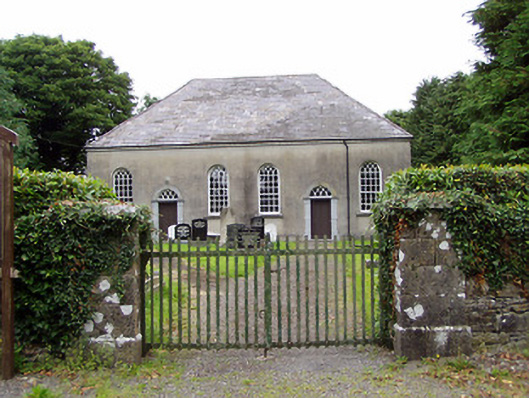 Corboy Presbyterian Churchchurch/chapel · 63 yd
 The Mansemanse · 85 yd
 BarrowBarrow, unclassified · 685 yd
 Enclosure in LisnanaghEnclosure · 1461 yd
 CastleCastle, motte · 1499 yd
 Oldtown DemesneForest · 1.5 mi
 Oldtown CopseWood · 1.6 mi
 Moat & CastleCastle, motte and bailey · 1.7 mi
 Bully's Acregraveyard/cemetery, unknown · 4.5 mi
 Saint Mel's CathedralCathedral · 5.0 mi
 National Famine WayWalking route · 5.2 mi
 Graveyard in Curry (ardagh By., Coolamber Ed)Graveyard · 6.2 mi
Other information
Photo: National Inventory of Architectural Heritage · Website use allowed for educational or private purposes with source credit