Places near here
Photo credits
- Jonathan Billinger, Wikimedia Commons · CC BY-SA 2.0
- National Inventory of Architectural Heritage
- Mike Searle, Wikimedia Commons · CC BY-SA 2.0
- Mike Searle, Geograph · CC BY-SA 2.0
- Jonathan Billinger, Geograph · CC BY-SA 2.0
- Pam Brophy, Geograph · CC BY-SA 2.0
- Andreas F. Borchert, Wikimedia Commons · CC BY-SA 4.0
- Richard Webb, Geograph · CC BY-SA 2.0
- EecherplazGinkgo06.jpg : Cayambe derivative work: Ginkgotree ( talk ), Wikimedia Commons · CC BY-SA 3.0
 Durrus CheeseVisitor attraction · 353 yd
Explorer Tom Durrus Cheese is hiding a secret treasure that is definitely a biscuit tin from 1998 tucked under the counter somewhere. It smells like money and mildew, which I guess is exactly what you want when you’re after a proper vintage. Pretend you're a lost aristocrat, nobody will check.
 church/chapel1.2 mi
Explorer Tom Killoveenoge’s chapel is retired from worship but still wearing its historic fabric like an old tuxedo to a casual party. It gave up on religion but kept the high-quality detailing. Practise your best 'oh wow' face.
_Durrus_-_geograph.org.uk_-_498585.jpg/250px-Church_of_St_James_(C_of_I)_Durrus_-_geograph.org.uk_-_498585.jpg "Photo: Mike Searle, Wikimedia Commons · CC BY-SA 2.0") St. James' ChurchChurch/chapel · 1.6 mi
St. James' ChurchChurch/chapel · 1.6 miExplorer Tom St. James' Church in Carrigboy has been rebuilt so many times it’s confused about its own age. The 1832 bell tower is the newest bit. Ring the bell if you dare, but don’t blame me for the noise.
 Coolnalong Castle (in Ruins)House, fortified house · 1.6 mi
Explorer Tom Coolnalong Castle is a U-shaped house that looks like it's trying to hug itself. It overlooks Dunmanus Bay and has some fancy oversailing chimney caps. It’s been used as a farm building, so maybe smell the cows before you explore.
 Rossmore Castle (in Ruins)Castle, tower house · 2.4 mi
Explorer Tom Rossmore Castle has a plan for retirement that involves being slowly eaten by ivy until it becomes one with the Dunmanus Bay landscape forever. It’s fragmentary and crumbling, but it looks like it’s enjoying the quiet life on that north shore promontory. Ten minutes here and you'll have a yarn for the pub.
 Lousy Castle IslandIslet · 2.6 mi
Explorer Tom Lousy Castle Island in County Cork is named so because the rabbits think it's an overrated piece of real estate that doesn't pay its rent properly. Stick around for the light changing on the water, because that's the only show this place really puts on all day long.
 Monumental PillarCross · 3.3 mi
Explorer Tom Monumental Pillar in Kilnaruane is a masterpiece with interlace and a boat scene that would make any sailor jealous. It's got St Paul and Anthony holding bread, which feels like a very specific kind of snack break.
 Derrylahard EastMountain / peak · 3.3 mi
Explorer Tom Derrylahard East claims the local inventor made it out of leftover clay from a failed pottery class, but the trees don't buy it. It’s half forest, half swamp, basically a nature experiment gone wrong. It's the kind of place that makes a dull Tuesday interesting.
 Rabbit IslandIslet · 3.4 mi
Explorer Tom Rabbit Island is telling the new development next door it’s too small to matter, which is very brave for such a tiny spot. Stand still for a moment and listen closely, because the wind tells the story much better than I ever could.
 Mount CorrinMountain / peak · 3.4 mi
Explorer Tom Mount Corrin in County Cork would tell a teenager that the 1800s were basically just everyone complaining about their boots being wet. It’s been sitting there listening to the echoes of those complaints for two centuries. Have a chat with it, nobody's watching.
 Ginkgo3.4 mi
Explorer Tom This Ginkgo in County Cork is currently in a bitter feud with the rain. It’s just shaking its leaves at the sky like ‘are you done yet?’. Toast it with a cup of tea and move on to the next one.
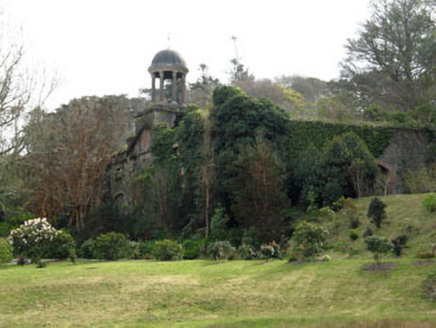 Bantry HouseStables · 3.6 mi
Explorer Tom Bantry House Stables in Seafield have a cupola and a pediment, which is fancy talk for 'it looks like a temple for horses.' It’s a twin to another building, so they probably share gossip. Imagine explaining this to a teenager who thinks stables are just mud pits. Smile big.
More walking routes in County Cork · All of County Cork

What do you know about this place?Tap to add a comment or ask a question