What is recorded here
From OpenStreetMap (© OpenStreetMap contributors) n4255955783
Places near here
Photo credits
- Maker not stated on source page, www.britainexpress.com
- Maker not stated on source page, nexusnewsfeed.com
- Maker not stated on source page, www.pinterest.com
- Nunulark, Wikimedia Commons · CC0
- Maker not stated on source page, www.stpeters.connor.anglican.org
- National Inventory of Architectural Heritage
- Graham Horn, Geograph · CC BY-SA 2.0
- Pam Brophy, Wikimedia Commons · CC BY-SA 2.0
- Espresso Addict, Wikimedia Commons · CC BY-SA 2.0
- Colin Park, Wikimedia Commons · CC BY-SA 2.0
- Mike Searle, Wikimedia Commons · CC BY-SA 2.0
- Tripadvisor visitor; individual photographer not stated, Tripadvisor visitor
 Standing stone in Gortnaboul LowerStanding stone · 1020 yd
Explorer Tom Standing stone in Gortnaboul Lower would tell its younger self to stop worrying about that notch on its side. It’s just…
 Fairy fort / earthen ringfort in Gortnaboul LowerFairy fort / earthen ringfort · 1168 yd
Explorer Tom Fairy fort in Gortnaboul Lower would ace a job interview by bragging about its massive external height of over four…
 Fairy fort / earthen ringfort in CummeenboyFairy fort / earthen ringfort · 1.0 mi
Explorer Tom Fairy fort / earthen ringfort in Cummeenboy has been hiding a scandal about stolen cattle for centuries. The bank is…
 KnockrowerMountain / peak · 1.1 mi
Explorer Tom Knockroe in County Kerry would bring its own dislodged capstone to any party as a conversation starter. It’s like a…
 St. Peters ChurchChurch · 4.3 mi
Explorer Tom St. Peters Church has been hiding a scandal involving a priest, a goat, and a very expensive hat for centuries. The…
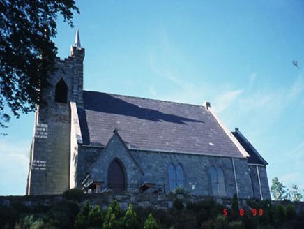 Michael J. Quill CentreChurch/chapel · 4.3 mi
Explorer Tom Michael J. Quill Centre in Fussa is hiding a secret message in its stones, probably about bad biscuits. It's a church…
 Muckross Lake WalkWalking route · 5.2 mi
Explorer Tom Muckross Lake Walk in County Kerry would teach history by making everyone stand in a puddle until they understood the…
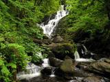 Torc WaterfallWaterfall · 5.2 mi
Explorer Tom If you hear a wild boar at Torc, check whether it is me puffing up the path. The name means boar, and the local tales…
 TooreencormickBattlefield · 5.5 mi
Explorer Tom Tooreencormick is playing hard to get, sitting on Mangerton like it’s keeping a secret from everyone. I hear a bishop…
 StoompaMountain / peak · 5.5 mi
Explorer Tom Stoompa sits east of Mangerton above Killarney, with a name that sounds like a giant crossing a wooden floor. The…
 Battle of CallannBattle · 5.7 mi
Explorer Tom Battle of Callan in Kerry suspects the postman is spying on its grave marker. Donal fell here, so it’s got a lot of…
 Kilgarvan Motor MuseumMuseum · 5.9 mi
Explorer Tom Kilgarvan Motor Museum at Slaheny has the dangerous power to make even a sensible driver say, “Just one more car,” for…
More mountains and hills in County Kerry · All of County Kerry

What do you know about this place?Tap to add a comment or ask a question