
What is recorded here
From OpenStreetMap (© OpenStreetMap contributors) n332372930
Places near here
Photo credits
- mozzercork @ flickr, Wikimedia Commons · CC BY 2.0
- Willow, Wikimedia Commons · CC BY 2.5
- Andrew Wood, Wikimedia Commons · CC BY-SA 2.0
- Bryan Conlon, Geograph · CC BY-SA 2.0
- National Inventory of Architectural Heritage
- Richard Fensome, Geograph · CC BY-SA 2.0
- Mike Searle, Wikimedia Commons · CC BY-SA 2.0
- Colin Park, Geograph · CC BY-SA 2.0
- Hywel Williams, Geograph · CC BY-SA 2.0
 Gougane BarraValley and heritage place · 1.8 mi
Explorer Tom Gougane Barra has had so many names it probably suffers from identity crisis. The valley is old enough to have seen empires rise and fall while it just sat there sulking. Take a breath of that air, it's older than your car.
 European ash1.9 mi
Explorer Tom European ash in Cork is terrified of dying young, so it's overthinking everything. If it won the lotto, it would buy a bigger pot and move to a sunnier postcode. Whisper a secret at it, it's heard worse from the weather vane.
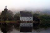
 Aireagal Naomh Finbarr [Saint Finbarr's Oratory]Church/chapel · 1.9 mi
Explorer Tom Aireagal Naomh Finbarr is on a tiny island at the source of the River Lee. Built in 1903, it’s very Celtic Revival and mystical. The door is always open, so don’t be shy, but mind the fish in the lake below.
 BealickMountain / peak · 2.4 mi
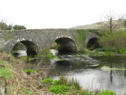 Inchinossig BridgeBridge · 3.1 mi
Explorer Tom Inchinossig Bridge thinks tourists from Dublin are all talk and no walk. Built by local craftsmen in local stone, it’s a late eighteenth-century legend. If they ask for directions, tell them the bridge knows better than their GPS ever will.
 Doughill MountainMountain / peak · 3.6 mi
 Callan Battlefield (Site of)Battlefield · 5.8 miBattle of CallannBattlefield · 5.9 mi
 Carriganass CastleCastle · 8.3 mi
Explorer Tom Carriganass Castle in County Cork was built by Dermot O'Sullivan Beare around 1540. Four storeys on a rocky base! Take a picture for me if you can spot the O'Sullivan Clan's old swagger.
Carriganass Castle (in Ruins)Bawn · 8.3 miExplorer Tom The Bawn at Carriganass is basically a giant stone square with nothing much inside it to see. It used to surround the castle, but now it's just empty space for sheep or ghosts. I'd bet there are secrets in those walls.
 The Priests LeapViewpoint · 8.6 mi
 GallaunsStone circle, five-stone · 8.7 mi
Explorer Tom Gallauns in Kealkill are five stones doing a tight little circle on the bog shoulder. Go in good boots and better humour, because that bog is not your friend at all.
More mountains and hills in County Cork · All of County Cork

What do you know about this place?Tap to add a comment or ask a question