
What is recorded here
Marked only on the 1930 ed. of the OS 6-inch map, and situated on a broad low hill. Described as a subcircular area (dims c. 111m E-W; c. 96m N-S) defined by an earthen bank (Wth c. 3.5m; int. H c. 0.5m; ext. H c. 1.2m) and outer fosse (Wth of base c. 1m) (Knox 1914b, 352-4). It is now visible as a subcircular…
Read the whole record
From the National Monuments Service (Archaeological Survey of Ireland) record RO028-093001
Places near here
Photo credits
- Maker not stated on source page, irishheritagenews.ie
- Maker not stated on source page, commons.wikimedia.org
- Tulsk GAA club website; individual photographer not stated, www.tulskgaa.ie
- Willow, Wikimedia Commons · CC BY 2.5
- Gillaween, Wikimedia Commons · CC BY-SA 4.0
- Sawyer777, Wikimedia Commons · CC BY-SA 4.0
- Maker not stated on source page, www.irishamerica.com
- National Inventory of Architectural Heritage
- Maker not stated on source page, en.wikipedia.org
- Maker not stated on source page, www.visitgalway.ie
- Mike Searle, Wikimedia Commons · CC BY-SA 2.0
 Fairy fort / earthen ringfort in Cloonanart MoreFairy fort / earthen ringfort · 856 yd
Explorer Tom Fairy fort / earthen ringfort in Cloonanart More holds a fake world record for 'Most Stones Stacked Without A Ladder'…
Fairy fort / earthen ringfort in Clooncullaan (roscommon By., Tulsk Ed)Fairy fort / earthen ringfort · 957 ydExplorer Tom Fairy fort / earthen ringfort in Clooncullaan is just a smudge on the hill that a cow once tried to buy with a carrot.…
 Kilcooley GraveyardGraveyard · 1535 yd
Explorer Tom Kilcooley Graveyard in Roscommon would order a triple portion of chips with mushy peas and absolutely no sauce, because…
 Tulsk Lord Edwards GAAGAA ground · 1.4 mi
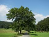 European ash2.7 mi
Explorer Tom European ash in County Roscommon has been the subject of some wild prophecies that never actually came true, which is…
 The Mórrígan: OweynagatLegend location · 4.7 mi
Explorer Tom The Mórrígan: Oweynagat is called the Cave of Cats, which fooled me into expecting a very ordinary sort of trouble.…
 Queen Medb: RathcroghanLegend location · 4.7 mi
Explorer Tom Queen Medb: Rathcroghan is where the Táin starts turning a quarrel about a bull into an epic. Medb had a royal seat…
 CastleCastle, unclassified · 9.8 mi
Explorer Tom Castle in Emlagh would tell its younger self to stop being so dramatic about crumbling. It’s just a pile of rocks…
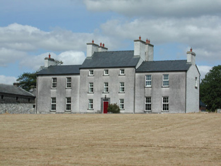 Dundermot HouseCountry house · 11 mi
Explorer Tom Dundermot House in Dundermot sits on a hill overlooking the River Suck, probably humming 'Country Roads' every single…
 Ballymoe BridgeBridge · 11 mi
Explorer Tom Ballymoe Bridge is gone, replaced by a 1978 concrete slab, but we all know a goat once fell off and landed in the river…
 Glinsk CastleVisitor attraction · 11 mi
Explorer Tom Glinsk Castle smells like a mix of old books, wet stone, and whatever the ghosts were having for dinner last night…
 Bawn in Glinsk (ballymoe By.)Bawn · 11 mi
Explorer Tom Bawn in Glinsk listens to what goes on inside the walls and probably hears the Burkes arguing about who left the light…
More archaeology and monuments in County Roscommon · All of County Roscommon

What do you know about this place?Tap to add a comment or ask a question