What is recorded here
Clooneen Mill in Clooneen once had two twelve-foot water wheels working for a modest corn mill. That's an awful lot of wheel for a bag of flour, like arriving to knead a loaf with two fully grown windmills under your arms.
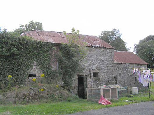
Former corn mill complex, built c. 1800, comprising three ranges of buildings. Now largely ruinous and partially in use as domestic outbuildings. Multiple-bay single- and two-storey range to northeast with pitched corrugated-metal roofs, rubble stone walls, square-headed openings with timber and corrugated-metal fittings, and elliptical-arched opening to southeast end. Multiple-bay single-storey range to the southeast having pitched slate roof with metal flue, partially rendered rubble stone walls and square-headed openings with timber fittings. Multiple-bay two-storey building to the northwest with half-hipped slate roof, rubble stone walls, and square-headed openings. Set with gable ends of southeast and the northwest ranges facing road, bounded by recent rubble stone wall to roadside. Located to the north of Granard.
This former corn mill, although now ruinous, retains much of its early character and form. Its modest scale indicates that it was a small-scale vernacular milling operation, rather than a large-scale industrial complex. The simple forms, the irregular fenestration and the many small openings are all typical. It probably dates to the late-eighteenth or early-nineteenth century, which was a boom period for the Irish corn milling industry. Although this complex is now derelict and the early machinery is now gone, it remains an important physical reminder of this prosperity and remains an important element of the industrial and economic history of the area. The range to the southeast is later than the rest of the complex and was probably built c. 1850 (Ordnance Survey six-inch maps 1838 and 1914). A corn kiln formerly stood to the west of the site, now no longer extant. The millrace formerly ran through the site from the north, entering a river/stream to the west of the site (across road). This mill was in the ownership of a Charles Major c. 1850, with two water wheels of twelve foot diameter and four pairs of grinding stones. One water wheel was in use for five months of the year, the other for three months (Valuation Office Mill Book).
From the Buildings of Ireland (National Inventory of Architectural Heritage) record 13400608
This does not grant access. Most recorded buildings are privately owned; view them only from public ground unless the owner allows entry.
Places near here
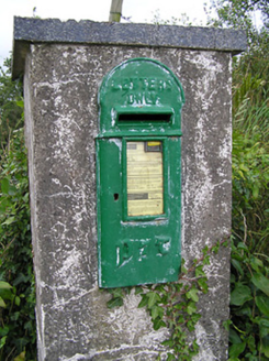 post box499 yd
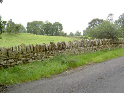 gates/railings/walls1123 ydCartronfreeMountain / peak · 1.2 miToomeMountain / peak · 2.0 miIndicatedCastle, unclassified · 2.3 miDerrycassan WoodsWood · 2.4 mi
 1798 MonumentMonument · 2.5 mi
 Granard MotteMotte-and-bailey castle remains · 2.6 mi
 Moat of GranardCastle, motte and bailey · 2.6 mi
 Sheela-na-gig in AbbeylaraSheela-na-gig · 3.7 mi
 Myles O'Reilly MonumentMemorial · 4.7 mi
 Portal tomb in AghnacliffPortal tomb · 5.1 mi
Pictures: National Inventory of Architectural Heritage; 2ManyCats4Me, Wikimedia Commons · CC0; Granard Motte.png : Smcq Derivative work: Hogweard, Wikimedia Commons · CC BY-SA 3.0; Gillaween, Wikimedia Commons · CC BY-SA 4.0; Cavanphotography, Wikimedia Commons · CC BY-SA 4.0; Wanfried-Dublin, Wikimedia Commons · CC BY-SA 4.0
More historic places in County Longford · All of County Longford
What do you know about this place?