Places near here
Photo credits
- louise price, Wikimedia Commons · CC BY-SA 2.0
- National Inventory of Architectural Heritage
- Kenneth Allen, Wikimedia Commons · CC BY-SA 2.0
- Bart Whelan, Geograph · CC BY-SA 2.0
- Bart Whelan, Wikimedia Commons · CC BY-SA 2.0
- Kenneth Allen, Geograph · Creative Commons Attribution-ShareAlike 2.0
- Kenneth Allen, Geograph · CC BY-SA 2.0
- P L Chadwick, Geograph · CC BY-SA 2.0
 Burial GroundGraveyard · 1.7 mi
Explorer Tom Burial Ground in Kilrean Upper is stacked with layers of history that refuse to stay quiet. You’ve got 12th-century…
 Owenea BridgeBridge · 2.1 mi
Explorer Tom Owenea Bridge carries the road over the river on five arches, the middle three larger than the outer pair. Built around…
 Ardara FortFairy fort / earthen ringfort · 2.1 mi
Explorer Tom Ardara Fort actually names the town next door. It’s a massive earthen platform rising three and a half metres above the…
 lime kiln2.3 mi
Explorer Tom Lime kiln in Cronkeeran was built c.1860, and it still looks like it’s holding a giant bag of chalky dust. I bet the…
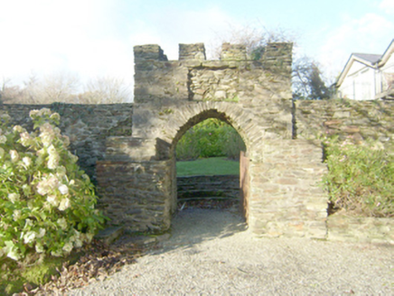 Wood HillWalled garden · 2.3 mi
Explorer Tom Wood Hill in Ardara is a walled garden with a circular bedding platform that looks like a giant target. It was built to…
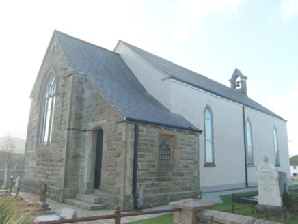 St. Conall's Church of Ireland ChurchChurch/chapel · 2.4 mi
Explorer Tom St. Conall's Church of Ireland Church has a tiny tower right on its roof! It’s just a small box holding a big bronze…
 Fionn Mc Cumhaill standing stonePublicly named standing stone · 2.4 mi
Explorer Tom Fionn Mc Cumhaill standing stone has a legend that it was thrown from a mountain to land in the Owenea river, which is…
 Ardara Methodist ChurchChurch/chapel · 2.4 mi
Explorer Tom Ardara Methodist Church is prepping for a job interview where it plans to claim it invented the concept of 'standing…
 Gatsby HouseHouse · 2.4 mi
Explorer Tom Gatsby House has an overlight that just announces itself with total confidence. I picture Con Kennedy in 1903, having…
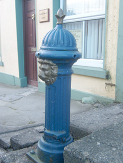 water pump2.4 mi
Explorer Tom The Water pump in Ardara has a colony of rabbits who think it’s a very fancy water fountain and keep trying to drink…
 CampbellsHouse · 2.4 mi
Explorer Tom Campbells in Ardara, built around 1860, has three gabled dormers above a shopfront added around 1950. The roof seems to…
 John DohertyMemorial · 2.5 mi
Explorer Tom John Doherty Memorial in County Donegal was built after forty-seven cups of tea were consumed in a single afternoon by…
More archaeology and monuments in County Donegal · All of County Donegal

What do you know about this place?Tap to add a comment or ask a question