
What is recorded here
From the National Monuments Service (Archaeological Survey of Ireland) record DG074-010
The monument record does not grant public access. Check the route and ask the landowner before entering private land.
- What survives
- Recorded monument
Places near here
 Ardara FortArchaeological place · 2 yd
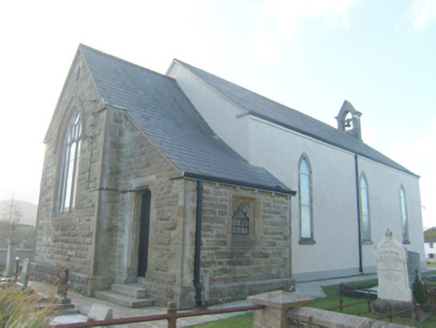 St. Conall's Church of Ireland ChurchChurch/chapel · 479 yd
 Ardara Methodist ChurchChurch/chapel · 530 yd
 John DohertyMemorial · 730 yd
 Fionn Mc Cumhaill standing stonePublicly named standing stone · 1358 yd
 IllancreeveIslet · 3.4 mi
 Carrickalahagh HeadlandPublicly named cliff or headland · 4.2 mi
 Assaranca WaterfallWaterfall · 4.4 mi
 Maghera WaterfallWaterfall · 4.4 mi
 Glengesh PassViewpoint · 4.4 mi
 Maghera StrandBeach / strand · 4.5 mi
 Bonny Glen Wood - Bonny Glen walkOfficial walking route · 4.6 mi
Pictures: Bart Whelan, Wikimedia Commons · CC BY-SA 2.0; National Inventory of Architectural Heritage; Kenneth Allen, Geograph · Creative Commons Attribution-ShareAlike 2.0; Kenneth Allen, Geograph · CC BY-SA 2.0; Robert Bone, Wikimedia Commons · CC BY-SA 2.0; Rossographer, Geograph · CC BY-SA 2.0; No machine-readable author provided. Bogman assumed (based on copyright claims)., Wikimedia Commons · CC BY-SA 2.5; Wilson44691, Wikimedia Commons · CC0; Rossographer, Wikimedia Commons · CC BY-SA 2.0
More archaeology and monuments in County Donegal · All of County Donegal
What do you know about this place?