
What is recorded here
A modern graveyard wall possibly built on traces of an older enclosure. Within the graveyard (DG074-009008-) is Kilrean church (DG074-009001-). This church, 16m by 6.2m, is represented by the lower rubble-built wall courses, c. 1m-1.3m in height. A secondary wall abuts the SW corner and incorporates a chamfered block, probably of a door-jamb. A number of dressed fragments (DG074-009007-) lie at the E end of the church. These include the sill for a single-light window, a small section, 20 cms of a medieval hollow-chamfered hood-mould and a round head (two moulded sandstone voussoirs with internal splay) of a single-light window which, together with other diagonally-tooled sandstone blocks in the S wall and graveyard gate posts, are possibly 12th century in date. S of the SW corner of the church is a cross-slab (DG074-009004-) with embryonic cross arms. The slab is 1.57m in height, .55m wide and 0.1m thick. On the W face is an elaborate ringed Latin cross covering most of the surface of the slab. At the centre of the cross are two concentric circles. At the top and base of the cross are two square-shaped designs consisting of interlocking triangles. In each of these is a smaller triangle all linked together by lines in a swastika fashion. On the E face of the cross there are five artificial notches. Also S of the church is a slab (DG074-009008) .63m high, .39m wide and 0.07m thick. On the W face vague traces of a worn cross can be discerned. Close to the W side of the enclosure is a slab (DG074-009009-) .93m x .47m x .08m. On the E face of the slab is a plain Latin cross. This slab is possibly modern. In a field SW of the graveyard is a grassed-over V-shaped stone-walled structure (DG074-009005-), 8.5m x 6.5m with an open end to the N. The wall is .5m wide. SE of the graveyard is a holy well (DG074-009003-) and to the E of the enclosure is an erratic boulder or piece of rock outcrop 1.65m x .85m with a carved rock-basin (DG074-009002-) .36m in diameter and 0.14m in depth. The site is located on generally rocky marshy land. The above description was derived from the 'Archaeological Survey of County Donegal. A description of the field antiquities of the County from the Mesolithic Period to the 17th century.' Compiled by: Brian Lacey with Eamon Cody, Claire Cotter, Judy Cuppage, Noel Dunne, Vincent Hurley, Celie O'Rahilly, Paul Walsh and Seán Ó Nualláin (Lifford: Donegal County Council, 1983).
A modern graveyard wall possibly built on traces of an older enclosure. Within the graveyard (DG074-009008-) is Kilrean church (DG074-009001-). This church, 16m by 6.2m, is represented by the lower rubble-built wall courses, c. 1m-1.3m in height. A secondary wall abuts the SW corner and incorporates a chamfered block, probably of a door-jamb. A number of dressed fragments (DG074-009007-) lie at the E end of the…
From the National Monuments Service (Archaeological Survey of Ireland) record DG074-009007
The monument record does not grant public access. Check the route and ask the landowner before entering private land.
- What survives
- Recorded monument
Places near here
 Myrtle CottageHouse · 1.6 mi
 St. Conall’s Catholic ChurchChurch/chapel · 1.8 mi
 St. Connell's Museum and Heritage CentreMuseum · 1.9 mi
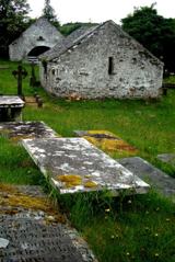 Inishkeel Graveyard near GlentiesGraveyard · 2.2 mi
 Letterilly Standing StonePublicly named standing stone · 2.9 mi
 Ardara FortArchaeological place · 3.6 mi
 Wych Elm3.9 mi
 John DohertyMemorial · 4.0 mi
 Binn BhánMountain / peak · 4.0 mi
 Cloghmeen HillMountain / peak · 4.6 mi
 Bonny Glen Wood - Bonny Glen walkOfficial walking route · 5.2 mi
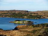 Doon FortFairy fort / stone ringfort · 7.0 mi
Pictures: National Inventory of Architectural Heritage; Eric Jones, Geograph · Creative Commons Attribution-ShareAlike 2.0; Kenneth Allen, Geograph · CC BY-SA 2.0; louise price, Wikimedia Commons · CC BY-SA 2.0; Kenneth Allen, Wikimedia Commons · CC BY-SA 2.0; Bart Whelan, Wikimedia Commons · CC BY-SA 2.0; Ronnie Nijboer, Wikimedia Commons · CC0; louise price, Geograph · CC BY-SA 2.0; Rossographer, Geograph · CC BY-SA 2.0
More archaeology and monuments in County Donegal · All of County Donegal
What do you know about this place?