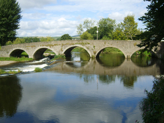
What is recorded here
Five-arch hump back road bridge over river, extant 1839. "Repaired", 1917. Part creeper- or ivy-covered coursed rubble stone walls centred on triangular cutwaters to piers to upriver (north) elevation having moss-covered pyramidal capping with rubble stone or schist diagonal soldier course coping to parapets. Series…
Read the whole record
From the Buildings of Ireland (National Inventory of Architectural Heritage) record 15700912
Places near here
Picture notes
- National Inventory of Architectural Heritage
- Computer-made picture. It does not show this monument.
- N Chadwick, Wikimedia Commons · CC BY-SA 2.0
- Sitomon, Wikimedia Commons · CC BY-SA 2.0
- Sciadopitys from UK, Wikimedia Commons · CC BY-SA 2.0
- Computer-made picture. It does not show this playground.
- kevin higgins, Geograph · CC BY-SA 2.0
- Theresa Bois, Wikimedia Commons · CC BY-SA 4.0
- kevin higgins, Wikimedia Commons · CC BY-SA 2.0
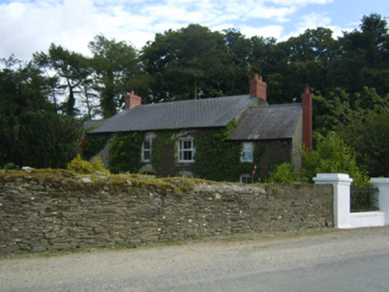 Clohamon LodgeFarm house · 158 yd
Explorer Tom Clohamon Lodge has caught my eye in Clohamon, County Wexford. I bet a farm house with a name like that could keep me talking all afternoon; I'm already inventing a daft little scene for it, and I'll stop before it turns into history.
 Maltings in CastlequarterMaltings · 161 ydTom: I’m here to help · Computer-made picture. It does not show this monument.
Explorer Tom Maltings in Castlequarter has caught my eye in Castlequarter, County Wexford. I bet a maltings with a name like that could keep me talking all afternoon; I'm already inventing a daft little scene for it, and I'll stop before it turns into history.
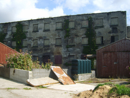 mill (water)269 yd
Explorer Tom Mill has caught my eye in Clohamon, County Wexford. I bet a mill (water) with a name like that could keep me talking all afternoon; I'm already inventing a daft little scene for it, and I'll stop before it turns into history.
 ExcavationExcavation, miscellaneous · 337 ydTom: I’m here to help · Computer-made picture. It does not show this monument.
Explorer Tom Excavation has caught my eye in Castlequarter, County Wexford. I bet a excavation, miscellaneous with a name like that could keep me talking all afternoon; I'm already inventing a daft little scene for it, and I'll stop before it turns into history.
 Battlefield in Ballyprecas,newtownbarryBattlefield · 1.7 mi
Explorer Tom Battlefield in Ballyprecas, Newtownbarry has caught my eye in Ballyprecas, Newtownbarry, County Wexford. I bet a battlefield with a name like that could keep me talking all afternoon; I'm already inventing a daft little scene for it, and I'll stop before it turns into history.
 European Yew1.7 mi
Explorer Tom European Yew has caught my eye in County Wexford. I bet a european yew with a name like that could keep me talking all afternoon; I'm already inventing a daft little scene for it, and I'll stop before it turns into history.
 European Larch1.7 mi
Explorer Tom European Larch has caught my eye in County Wexford. I bet a european larch with a name like that could keep me talking all afternoon; I'm already inventing a daft little scene for it, and I'll stop before it turns into history.
1798 rebellion Battle of Newtownbarry (aka Bunclody) commemorative plaqueMemorial · 1.8 miExplorer Tom 1798 rebellion Battle of Newtownbarry commemorative plaque has caught my eye in County Wexford. I bet a memorial with a name like that could keep me talking all afternoon; I'm already inventing a daft little scene for it, and I'll stop before it turns into history.
 Children's playground2.2 miTom: I’m here to help · Computer-made picture. It does not show this playground.
Explorer Tom Children's playground in County Carlow is playing hide-and-seek with me. A local legend says the seesaw can fly if both sides are balanced by people who are telling the truth.
 John's HillMountain / peak · 3.6 mi
Explorer Tom John's Hill is shrouded in heathland and forest; at 361m, it’s a great spot to feel small under the vast, open Irish sky.
.jpg/250px-Huntington_Castle,_Co._Carlow_(back).jpg "Photo: Theresa Bois, Wikimedia Commons · CC BY-SA 4.0") Huntington Castle & GardensHeritage attraction · 3.8 mi
Huntington Castle & GardensHeritage attraction · 3.8 miExplorer Tom Huntington Castle & Gardens is a beautiful heritage attraction, and the castle itself looks absolutely stunning in the photos.
 GreenogeMountain / peak · 4.6 mi
Explorer Tom Greenoge is a peak in County Carlow; the name sounds soft and green, like a gentle hill covered in lush, wild clover fields.
More historic places in County Wexford · All of County Wexford

What do you know about this place?Tap to add a comment or ask a question