
What is recorded here
Cloghanaffrin/Cloch an Aifrinn: Located in rough pasture, in a commanding position close to the Spunkane-Termons townland boundary, this upright cross-inscribed stone overlooks Lough Currane to S and Ballinskelligs Bay to W. Widening at the top, the trapezoidal slab stands .98m high and measures .27m x .12m at base;…
Read the whole record
From the National Monuments Service (Archaeological Survey of Ireland) record KE098-008
Places near here
Picture notes
- Computer-made picture. It does not show this monument.
- National Inventory of Architectural Heritage
- Computer-made picture. It does not show this playground.
- Matthew Chadwick, Wikimedia Commons · CC BY-SA 2.0
- Computer-made picture. It does not show this mountain top.
- Ian S, Wikimedia Commons · CC BY-SA 2.0
- Jonathan Thacker, Geograph · CC BY-SA 2.0
- Steve Edge, Wikimedia Commons · CC BY-SA 2.0
- Shaun Ferguson, Geograph · CC BY-SA 2.0
- Gerd Eichmann, Wikimedia Commons · CC BY-SA 4.0
 Rock art in SpunkaneRock art · 197 ydComputer-made picture
Explorer Tom Rock art in Spunkane hosted a dance that went so far it broke two cups. The villagers still whisper about who started it all. Stand still and listen, the wind tells it better than me.
 CaveMan-made underground passage · 413 ydComputer-made picture
Explorer Tom Cave in Spunkane is doing its best impression of a cave but it’s mostly just a heap of rocks and secrets. It’d say, 'I'm great at networking,' in an interview. Grand place for a sulk or a snog, your call.
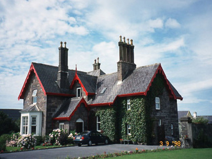 Iveragh LodgeHunting/fishing lodge · 1467 yd
Explorer Tom Iveragh Lodge was built for hunting, but I bet the builder was just trying to impress his in-laws. It looks like an L-shaped apology for taking up space on a hill. Bring your worst joke, the place has heard worse.
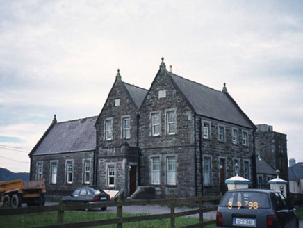 The Cable StationCoastguard station · 1626 yd
Explorer Tom Another Cable Station, this time in Spunkane, had a fiddler play all night to keep the ghosts away. It’s been a coastguard station too, so it knows how to spot trouble coming from far off. Toast it with a cup of tea and move on to the next.
 Waterville PlaygroundChildren's playground · 1750 ydComputer-made picture
 Butler MemorialMemorial · 1.2 mi
 KnagMountain / peak · 1.2 miComputer-made picture
 Charlie ChaplinStatue · 1.2 mi
 Waterville PromenadeWalking route · 1.4 mi
 Inny StrandBeach / strand · 1.7 mi
 Emlagh LoopWalking route · 2.6 mi
 Bá na ScealgBay · 3.2 mi
More archaeology and monuments in County Kerry · All of County Kerry

What do you know about this place?Tap to add a comment or ask a question