
What is recorded here
From the National Monuments Service (Archaeological Survey of Ireland) record ME019-014
Places near here
Photo credits
- Kmcnamee, Wikimedia Commons · CC BY-SA 4.0
- Maker not stated on source page, en.wikipedia.org
- Kieran Campbell, Geograph · CC BY-SA 2.0
- National Inventory of Architectural Heritage
- Maker not stated on source page, commons.wikimedia.org
- Maker not stated on source page, www.pinterest.ca
- Maker not stated on source page, ca.wikipedia.org
- Mike Searle, Wikimedia Commons · CC BY-SA 2.0
- Maker not stated on source page, www.dreamstime.com
 Slane GAA pitchGAA ground · 988 yd
 Flat cemetery in MonknewtownFlat cemetery · 1269 yd
Explorer Tom Flat cemetery in Monknewtown sits inside a henge that looks like a giant’s abandoned picnic circle. Locals say if you…
 Church (in Ruins)Church · 1652 yd
Explorer Tom Church in Monknewtown is hiding a scandal involving a chaplain named Thomas Alen who probably didn’t clean his boots…
 Holy well in MonknewtownHoly well · 1739 yd
Explorer Tom This Holy well in Monknewtown claims to be older than time itself, but its exact location is so fuzzy you could drive a…
 mill (water)1743 yd
Explorer Tom This Mill in Monknewtown is proud of its red brick chimneystack more than it is of actually grinding grain. It…
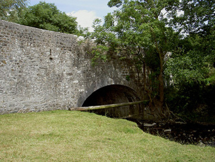 Wood Mill BridgeBridge · 1.1 mi
Explorer Tom Wood Mill Bridge in Kellystown is where Vikings got lost looking for their ships because they were too busy admiring…
 Littlewood ForestVisitor information · 1.3 mi
Explorer Tom Littlewood Forest in County Meath is probably posting updates on social media about how majestic it is, complete with…
 Linear earthwork in SlaneLinear earthwork · 1.6 mi
Explorer Tom Linear earthwork in Slane made a New Year's resolution to finally move two inches west, but it has been procrastinating…
 Saint Patrick's Church GraveyardGraveyard · 2.3 mi
Explorer Tom Saint Patrick's Church Graveyard in County Meath is still seething because that one bishop refused to visit back in the…
 Fenor CastleCastle, tower house · 2.3 mi
Explorer Tom Fenor Castle is perched on that steep slope like it's trying to look down its nose at the River Boyne below. The map…
 Fennor CastleCastle · 2.3 mi
Explorer Tom Fennor Castle would tell its younger self to stop worrying about the roof and start enjoying the view, but it’s too…
 Beech ClumpWood · 2.9 mi
Explorer Tom Beech Clump was nearly sold off as a very expensive horse because someone mistook its silhouette for a noble steed in…
More archaeology and monuments in County Meath · All of County Meath

What do you know about this place?Tap to add a comment or ask a question