What is recorded here
Monknewtown’s flat cemetery hides twelve cremated burials inside the henge bank, where red clay and rounded stones still mark pits dug before memory faded. One cist held an adult male skull beside a burned cremation, while another pit kept a child’s remains with a Carrowkeel ware bowl. The empty graves may have been forgotten, abandoned or stripped by later hands, yet the repeated shape of the holes suggests a place where people returned to give the dead a visible share of the earth.
Located on a slight E-facing slope and inside the bank of the henge (ME019-016001-) NW-NE. Archaeological excavation (E000090) in 1970 recorded 12 cremated burials, 9 in pits often with rounded stones closing the pit, and 2 in cists while one was on the old ground surface. Some of the pits had no contents, although all were covered with a red clay that appeared to have been introduced.
Pit 1 (dims 1m x 0.8m; D 0.45m) had no bones or artefacts but was covered by a large stone (dims 1.05m x 0.4m) which may have been a grave-marker. Pit 2 was a shallow depression with a Carrowkeel ware bowl and the cremated remains of a child. Pit 3 (dims 1.75m x 1.25m; D 0.5m) was covered by small overlapping stones but had no bones or artefacts. Pit 4 was rectangular (dims 1.1m x 0.9m; D 0.5m) and had some cremated bone near the top but produced no artefacts. Pit 5 was a polygonal cist (dims c. 0.45m x c. 0.4m; D c. 0.6m) consisting of 6 upright slabs splaying outwards slightly as they rose but there was no covering stone, which may have been removed in recent land works. A small amount of cremated bone was on the flag floor. Pit 6 was a polygonal cist (dims c.0.95m E-W; c. 0.7m N-S; D 0.45m) with 8 upright slabs and some collapsed drystone walling covered by a single capstone (1.4m x 0.9m; T 0.25m). It had a flagstone at the W edge of the base on which was a cremation, while just to the W and slightly higher in the fill was the partially burned skull and part of the pelvis of an adult male aged 30-40 years. (Sweetman 1971, 136).
Pit 7 (dims 0.7m x 0.4m; D 0.35m) was filled with gravel and a few fragments of cremated bone. Pit 8 was circular (diam. 1.1m; D 0.5m) and had a setting of three stones which covered the remains of a large bucket-shaped vessel (diam. of base 0.17m; H 0.3m) that contained large pieces of cremated bone. Pit 9 was a circular straight-sided pit (diam. 1.3m; D 0.5m) lined with flat stones at the base, but only a single flint was found in the gravel fill. Pit 10 (diam. 0.8m; D 0.4m) was filled with gravel but contained neither bones nor artefacts. Pit 11 was a small pit with some cremated bone which was marked by a large flagstone (dims 0.6m x 0.65m). Beneath the flagstone was a large pit (diam. 2.3m; D c. 0.5m) cut through the tail of the bank of the henge. It contained two concentrations of rounded stones. Pit 12 was circular (diam. c. 0.7m; D c. 0.4m) and filled with gravel. (Sweetman 1976, 28-35)
Compiled by: Michael Moore
The above description is derived from the published 'Archaeological Inventory of County Meath' (Dublin: Stationery Office, 1987). In certain instances the entries have been revised and updated in the light of recent research.
Date of upload: 10 July 2007
Amended: 28 January 2021
Neolithic flat cemetery, dating to approximately 3000–2500 BCE. Its association with a henge and the presence of cremated burials in pits indicate its significance as part of a broader ceremonial landscape used for funerary practices during the Neolithic period.
The monument record does not grant public access. Check the route and ask the landowner before entering private land.
- What survives
- Recorded monument
Places near here
 Enclosure in MonknewtownEnclosure · 414 yd
 Font (present location) in MonknewtownFont (present location) · 415 yd
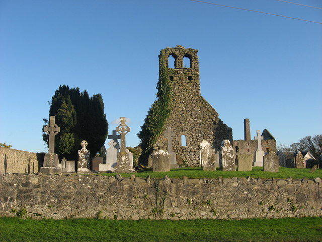 Church (in Ruins)Church · 487 yd
 mill (water)mill (water) · 572 yd
 School WoodForest · 1.4 mi
 Knowth Timber CircleHeritage attraction · 1.4 mi
 KnowthArchaeological place · 1.5 mi
 Quarry Garden WoodForest · 1.5 mi
 Dowth CastleCastle, tower house · 1.6 mi
 Proudfootstown CastleCastle, unclassified · 1.8 mi
 Brú na Bóinne Visitors CentreVisitor information · 2.1 mi
 Hurcle HillMountain / peak · 2.3 mi