What is recorded here
On the summit of Seefin Mountain. A cairn (LI056-032001-) lies 32m to the W. Not marked on historic OSi maps. National Museum of Ireland Field Monuments Files described the site as a ‘polygonal cist with encrusted urn and cremated bone found in 1941’. No surface remains visible on Digital Globe orthoimage taken between 2011-13 and on Google Earth orthoimages. See attached Google Earth orthoimage
Compiled by: Fiona Rooney
Date of upload: 25 November 2021
From the National Monuments Service (Archaeological Survey of Ireland) record LI056-032002
The monument record does not grant public access. Check the route and ask the landowner before entering private land.
- What survives
- Recorded monument
Places near here
 Seefin Mountain East TopMountain / peak · 51 yd
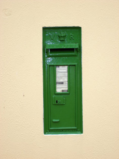 post box953 yd
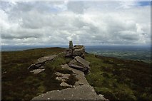 Seefin Mountain West TopMountain / peak · 991 yd
 worker's house1003 yd
 Castle OliverCastle · 1.4 mi
.jpg/250px-Castle_Oliver_(1).jpg "Photo: Mygodfrey at en.wikipedia, Wikimedia Commons · CC BY-SA 3.0") Castle OliverCastle · 1.4 miCathair na caillighe - HachuredFairy fort / earthen ringfort · 1.6 miToberpatrickSpring · 1.9 mi
Castle OliverCastle · 1.4 miCathair na caillighe - HachuredFairy fort / earthen ringfort · 1.6 miToberpatrickSpring · 1.9 mi ‘Cloigtheach (Round Tower)’Round tower · 2.1 miBallyhoura tourist informationVisitor information · 3.6 miPalatine's RockNamed rock · 4.1 miBallyhoura WayWalking route · 4.1 mi
Pictures: Colin Park, Geograph · CC BY-SA 2.0; National Inventory of Architectural Heritage; Mike Searle, Wikimedia Commons · CC BY-SA 2.0; Mygodfrey at en.wikipedia, Wikimedia Commons · CC BY-SA 3.0; Andreas F. Borchert, Wikimedia Commons · CC BY-SA 4.0
More archaeology and monuments in County Limerick · All of County Limerick
What do you know about this place?