DDiscover AloneMapAbout

Church in Rathculbin

Church
Church in Rathculbin
Representative picture, exact place not confirmed
Photo: Maker not stated on source page, en.wikipedia.org · Report the wrong picture

This remains an important historical record, but the official description says the monument is no longer visible or has been destroyed. The monument record does not grant public access. Check the route and ask the landowner before entering private land.

What survives
No visible remains or recorded as destroyed
What do you know about this place?Tap to add a comment or ask a question

What you write will be public.

What is recorded here

According to Carrigan (1905, vol. 3, 324), ‘The townlands of Rathculbin and Spruce’s Hay made up the ancient parish of Rathculbin. This parish is mentioned in the Red Book of Ossory as Rathgulby, Ragulby and Rakylbyn. Soon after the Norman Invasion Rathculbin was granted to Ralph de Borard, who appropriated its free…

Read the whole record
According to Carrigan (1905, vol. 3, 324), ‘The townlands of Rathculbin and Spruce’s Hay made up the ancient parish of Rathculbin. This parish is mentioned in the Red Book of Ossory as Rathgulby, Ragulby and Rakylbyn. Soon after the Norman Invasion Rathculbin was granted to Ralph de Borard, who appropriated its free chapel (contulit liberam capellam praedictae villae de Rathgulby,) to the Priory of Kells…The chapel of Rathgulby, with its glebe, is mentioned among the possessions of Kells Priory in 1411’. The location of the church is unknown, however, Carrigan suggests several possibilities, including, ‘a very large circular rath [KK027-067----] in Rathculbin, about 4 acres in extent, and enclosed by an earthen rampart, which, though much obliterated, is still traceable. The public road from Mallardstown to Newtown chapel runs right through it, dividing it into two nearly equal parts. Within the circuit of the rath, in Mr. Hoyne’s yard [Hoynes?], are the remains of an old house [KK027-025----], which was occupied by one Elliot about 1760’. There is no visible trace of this enclosure at ground level. Carrigan (ibid. 324-5) also mentions, ‘another rath [KK027-059002-] in the townland, in a large field at the cross-roads of Rathculbin, called Bawnarawha, or the Rath field. This rath is known to the old people as the “Rellig,” that is, the churchyard, and though its interior now presents no appearances of a churchyard, or of foundations of walls, there can be no question that it is the site of the ancient chapel of Rathculbin’. It is possible that this is the enclosure (KK027-090----) which was identified as a cropmark on satellite imagery (OS Ortho, imagery date 2004-2006; DigitalGlobe, imagery date 2011-2013) is the same as the ‘Reillig’, it is located c. 160m WSW of the cross-roads of Rathculbin, on the N side of the Mallardstown-Newtown church road and c. 30m E of the farmyard which contains the remains of a ruined late 16th/early 17th-century house (KK027-025----). Carrigan (ibid. 325), also provides a third option, ‘a third rath, or what, at least, resembled a rath, here, in Rathculbin “Bawn,” a field belonging to a farmer named Torpey. The late owner, Mr. Thomas Torpey, described it to the writer as a circular area, enclosed by an earthen rampart, and overgrown with white-thorns. It area was a quarter of an acre. It was levelled many years ago by his father, who, in the course of the work, came upon human bones’. This enclosure (KK027-068001-) and the burials (KK027-068002-) are unlocated within the townland.

From the National Monuments Service (Archaeological Survey of Ireland) record KK027-059001

Places near here

Photo credits
  • Maker not stated on source page, www.pngwing.com
  • Mike Searle, Wikimedia Commons · CC BY-SA 2.0
  • National Inventory of Architectural Heritage
  • Mike Searle, Geograph · CC BY-SA 2.0
  • Maker not stated on source page, www.britannica.com
  • Maker not stated on source page, tr.pinterest.com
  • A.-K. D., Wikimedia Commons · CC BY-SA 4.0
  • Maker not stated on source page, www.alamy.com
  • Maker not stated on source page, www.dreamstime.com
CastleCastle, unclassified · 512 yd

Explorer Tom Castle in Spruceshay is guarding a bridge that looks like it’s about to take a nap. A priest lost a bet there once and…

Castle (in ruins)House, 16th/17th century · 748 yd

Explorer Tom Castle in Rathculbin holds the fake world record for having the least amount of castle left standing after a storm.…
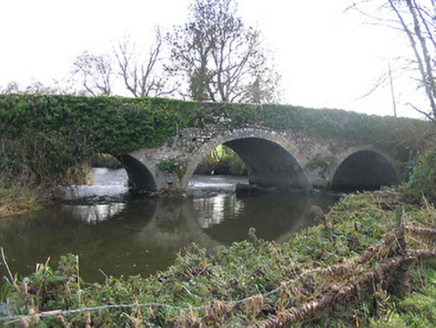
Newtown BridgeBridge · 1022 yd

Explorer Tom Newtown Bridge has been hiding a scandal for centuries about a time it let a horse cross without paying the toll. Its…

TowerHouse, fortified house · 1224 yd

Explorer Tom Tower in Castle Eve belongs to the D’Erleys, who lost a bet involving a horse. The priest involved still regrets his…

Bawn in Castle EveBawn · 1231 yd

Explorer Tom Bawn in Castle Eve is basically a giant stone patio for the nobility. It would order the double chips with extra gravy…

Bawn in Newtown (baker)Bawn · 1257 yd

Explorer Tom Bawn in Newtown had a bishop refuse to visit because he couldn't find the Wi-Fi, or something like that. The Sweetmans…

Castle Eve (ruins)Archaeological place · 1261 yd

Explorer Tom Castle Eve in County Kilkenny is a shortcut that leads you straight back to where you started, but with more mud on…

Armorial plaque in Castle EveArmorial plaque · 1264 yd

Explorer Tom Armorial plaque in Castle Eve belonged to John Sweetman, whose escape plan involved hiding his family crest inside a…

Church (in ruins)Church · 1456 yd

Explorer Tom Church in Newtown has been watching the Kings River flow since the thirteenth century, and honestly, it’s seen better…

Newtown (Baker) GraveyardCemetery · 1460 yd

Explorer Tom Newtown (Baker) Graveyard would make Saint Patrick drop his crocus and ask for a biscuit. It’s got that warm, inviting…

Grave YardGraveyard · 1463 yd

Explorer Tom Graveyard in Newtown Baker wants to explain the 1800s to a teenager using only sighs and mossy stones. It says everyone…

Mallardstown Great GraveyardGraveyard · 1.1 mi

Explorer Tom Great Graveyard in County Kilkenny has a family tree that’s mostly invented nonsense, like a cousin who never actually…

More historic places in County Kilkenny · All of County Kilkenny

Add to this placeAdd a picture Add a detailed tip Add a story

Explore the map1,095,414 places to discover

Next place · or swipeCastle