Places near here
Photo credits
- National Inventory of Architectural Heritage
- MickReynolds, Wikimedia Commons · CC BY-SA 4.0
- Patrice78500, Wikimedia Commons · Public domain
- Kmcnamee, Wikimedia Commons · CC BY-SA 4.0
- Unknown author Unknown author, Wikimedia Commons · Public domain
- Matthew Chadwick, Wikimedia Commons · CC BY-SA 2.0
- No machine-readable author provided. Larsoner~commonswiki assumed (based on copyright claims)., Wikimedia Commons · Public domain
- N Chadwick, Geograph · CC BY-SA 2.0
- Colin Park, Geograph · CC BY-SA 2.0
- Photogoddle, Wikimedia Commons
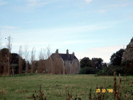 Rattoo HouseHouse · 2.5 mi
Explorer Tom Rattoo House in Rattoo is Venetian Gothic flash that scared off a bishop who thought it was too fancy for his boots. It…
 Rattoo Church (in ruins)Church · 2.5 mi
Explorer Tom Rattoo Church sits there looking smug, guarding secrets it’d only spill after three pints. It’s been standing in that…
 Round Tower2.5 mi
Explorer Tom Round Tower in Rattoo has a secret it would only tell after a few pints: that its top was replaced in 1880 because it…
 Finuge GAA pitchGAA ground · 2.9 miBallyduff GAA pitchGAA ground · 3.4 mi
 Lartigue MonorailMuseum · 4.2 mi
Explorer Tom The Lartigue Monorail would post a selfie on social media claiming it's the fastest train in the world, despite going…
 Listowel CastleVisitor attraction · 4.3 mi
Explorer Tom Listowel Castle still towers over The Square and the River Feale as if someone forgot to tell it that the siege ended…
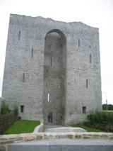 Listowel Castle (in ruins)Castle, tower house · 4.3 mi
Explorer Tom Listowel Castle sits by the River Feale, acting like it invented the square. A local claims he built it with a spoon…
 Bryan MacMahonMemorial · 4.4 mi
Explorer Tom Bryan MacMahon memorial in County Kerry was once taken over by a fox who decided to use his hat as a nest. The statue…
 John B. KeaneMemorial · 4.4 mi
Explorer Tom John B. Keane would describe himself as “a bit of a character” if he were here, which is the most Irish self-assessment…
 CastleCastle, tower house · 5.8 mi
Explorer Tom Ballybunnion Castle is just one stubborn wall standing on a cliff, probably because the map makers got drunk and drew…
 Ballybunion Men’s BeachSurfing beach · 5.8 mi
Explorer Tom Men’s Beach sits under Ballybunion Castle, where a very old watchtower gets a front row seat for every new surfer's…
More historic places in County Kerry · All of County Kerry

What do you know about this place?Tap to add a comment or ask a question