What is recorded here
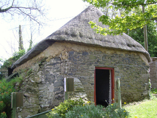
Detached single-bay single-storey single-cell thatched mass house, ----, on a rectangular plan. Closed, 1813. "Restored", 2003. Chicken wire-covered replacement hipped oat or wheat thatch roof on collared timber construction with exposed hazel lattice stretchers to ridge having exposed scallops, and exposed hazel stretchers to eaves having exposed scallops. Part repointed coursed rubble stone battered walls with rubble stone battered buttresses. Square-headed door opening with rough hewn rubble stone lintel framing timber boarded door. Limewashed interior with timber kneelers. Set in landscaped grounds on an elevated site approached by flight of rough hewn rubble stone steps.
A mass house representing an important component of the built heritage of County Wexford with the underlying vernacular basis of the composition, one bridging the period of worship between the opposing Tomhaggard Church (see 15704774) and the diagonally opposing Catholic Church of Saint James and Saint Anne (see 15704776), confirmed by such attributes as the compact rectilinear plan form; the construction in unrefined local fieldstone displaying a pronounced battered silhouette with the removal of the limewash finish revealing sections of "daub" or mud; and the high pitched roof showing a thatch finish "restored" with the financial assistance of a grant (2003) from The Heritage Council: meanwhile, such traits as '[a] window embrasure [adapted] as [an] altar shelf' [SMR WX047-05001-; SMR WX047-05002-] highlight the archaeological potential of a mass house making a pleasing visual statement in a rural village setting.
From the Buildings of Ireland (National Inventory of Architectural Heritage) record 15704775
This does not grant access. Most recorded buildings are privately owned; view them only from public ground unless the owner allows entry.
Places near here
Photo credits
- National Inventory of Architectural Heritage
- Mike Searle, Wikimedia Commons · CC BY-SA 2.0
St. James WellHoly well · 45 yd Tomhaggard HouseFarm house · 54 ydwater pump54 yd1798 Memorial PlaqueMemorial · 55 ydEcclesiastical enclosure in TomhaggardEcclesiastical enclosure · 103 ydCastleCastle, tower house · 789 ydThe Bull RockForest · 924 ydThe Heron's MeadowForest · 1198 ydThe White Hole BeachBeach / strand · 1.7 miThe HamBay · 1.7 miCastle (in ruins)Castle, tower house · 2.2 miBallyhealy BeachBeach / strand · 2.3 mi
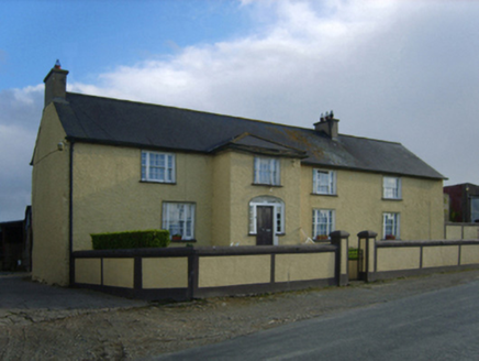 Tomhaggard HouseFarm house · 54 yd
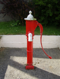 water pump54 yd1798 Memorial PlaqueMemorial · 55 ydEcclesiastical enclosure in TomhaggardEcclesiastical enclosure · 103 ydCastleCastle, tower house · 789 ydThe Bull RockForest · 924 ydThe Heron's MeadowForest · 1198 ydThe White Hole BeachBeach / strand · 1.7 miThe HamBay · 1.7 mi
_-_geograph.org.uk_-_3715787.jpg/250px-Castles_of_Leinster,_Ballyhealy,_Wexford_(1)_-_geograph.org.uk_-_3715787.jpg "Photo: Mike Searle, Wikimedia Commons · CC BY-SA 2.0") Castle (in ruins)Castle, tower house · 2.2 miBallyhealy BeachBeach / strand · 2.3 mi
Castle (in ruins)Castle, tower house · 2.2 miBallyhealy BeachBeach / strand · 2.3 miMore historic places in County Wexford · All of County Wexford
What do you know about this place?