What is recorded here
References to Lingstown date from the 16th century. Sir James Synnott, the brother of Sir Richard Synnott of Ballybrennan castle (WX048-001001-) is thought to have married a Lambert of Lingstown. Edmond Synnott owned 80 acres at Lingstown when he died in 1630 (Jeffrey 1979, 26), but according to the Book of Survey and Distribution John Devereux owned 27 acres at Lingstown and Alexander Rossiter owned 73 there in 1640 (Simington 1953, 303). The castle is marked on the Down Survey map barony map (1656-8). It was situated on rock outcrop overlooking a N arm of Tacumshin Lough, but it collapsed in 1985 (Murphy 1984-6). It was described by John O’Donovan writing c. 1840 as ’26 feet by 23 feet by 44 feet high (c. 7.9m x 7m; H c. 13.4m’ (O’Flanagan 1933, vol. 1, 285). It can be described from photographs, sketches and local accounts (SMR file) as having had entrance with a pointed arch of dressed stone, protected by a possible portcullis, machicolation and a murder hole, towards the W end of the N wall. There was a stairs rising in the N wall to the first floor under the E-W vault, and on to the second floor. A spiral stairs at the NE angle gave access to the third and fourth floors and the battlements. There were gables on the N and S walls with an entrance to the attic at N. A chimney stack rose over the stepped battlements on the N side and there was a lookout platform over the stairs housing at NE. The rubble from the tower house is now on the site.
References to Lingstown date from the 16th century. Sir James Synnott, the brother of Sir Richard Synnott of Ballybrennan castle (WX048-001001-) is thought to have married a Lambert of Lingstown. Edmond Synnott owned 80 acres at Lingstown when he died in 1630 (Jeffrey 1979, 26), but according to the Book of Survey and Distribution John Devereux owned 27 acres at Lingstown and Alexander Rossiter owned 73 there in…
From the National Monuments Service (Archaeological Survey of Ireland) record WX047-061
The monument record does not grant public access. Check the route and ask the landowner before entering private land.
- What survives
- Recorded monument
Places near here
Photo credits
- National Inventory of Architectural Heritage
- Cozzmick, Wikimedia Commons · CC BY-SA 4.0
Enclosure in Grange (forth By., Tomhaggard Ed)Enclosure · 441 ydMass-rock in TomhaggardMass-rock · 615 yd graveyard/cemetery735 yd1798 Memorial PlaqueMemorial · 782 ydchurch/chapel789 ydThe Bull RockForest · 1176 ydCastleCastle, tower house · 1354 ydThe Heron's MeadowForest · 1426 ydThe HamBay · 1.2 miThe White Hole BeachBeach / strand · 1.6 miCastleCastle, tower house · 1.7 miSigginstown Island (Little)Islet · 2.0 mi
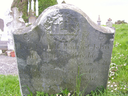 graveyard/cemetery735 yd1798 Memorial PlaqueMemorial · 782 yd
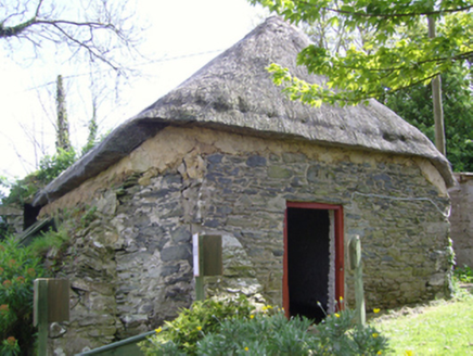 church/chapel789 ydThe Bull RockForest · 1176 ydCastleCastle, tower house · 1354 ydThe Heron's MeadowForest · 1426 ydThe HamBay · 1.2 miThe White Hole BeachBeach / strand · 1.6 mi
 CastleCastle, tower house · 1.7 miSigginstown Island (Little)Islet · 2.0 mi
More castles and forts in County Wexford · All of County Wexford
What do you know about this place?