What is recorded here
Situated in woodland on the N side of the public road which marks the townland boundary with Ballynagall. A quarry is located E of the site. On the N side of Kilmaglish graveyard (WM012-122001-) are the poorly preserved remains of an ivy-covered rectangular chapel (approx. dims. 14.6m E-W; 7.3m N-S; wall T 0.7m; max.…
Read the whole record
From the National Monuments Service (Archaeological Survey of Ireland) record WM012-122
Places near here
Photo credits
- Maker not stated on source page, thehazeltree.co.uk
- National Inventory of Architectural Heritage
- Angela Hawkesworth Smyth, Wikimedia Commons · Public domain
- kevin higgins, Wikimedia Commons · CC BY-SA 2.0
- Maker not stated on source page, www.pinterest.com
- kevin higgins, Geograph · CC BY-SA 2.0
- Maker not stated on source page, commons.wikimedia.org
- Maker not stated on source page, www.myhighlands.de
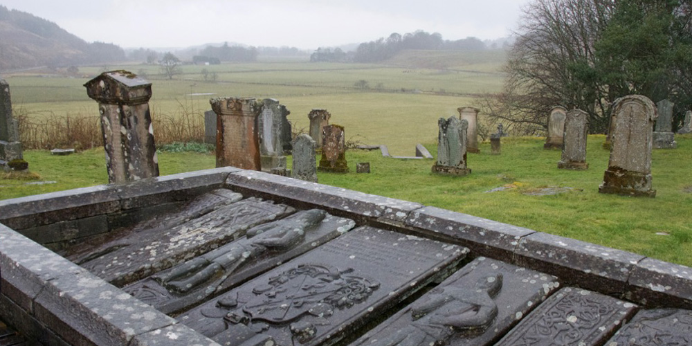 Kilmaglish GraveyardGraveyard · 12 yd
Explorer Tom Kilmaglish Graveyard’s name actually means 'The Place Where I Left My Keys' if you ask me, which is probably true. It’s…
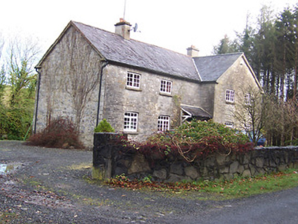 Woodview HouseHouse · 521 yd
Explorer Tom Woodview House in Ballynagall has a ridiculous smuggling story where they used to hide barrels of whiskey inside its…
 BallynagallCountry house · 686 yd
Explorer Tom Ballynagall in Westmeath was a Regency stunner that a single stubborn goat once claimed as its throne. The £30,000…
 Ballynegall HouseRuins · 690 yd
Explorer Tom Ballynegall House is secretly proud of the one potato growing through its floorboards, which is honestly more…
 CastleCastle, unclassified · 692 yd
Explorer Tom Castle in Ballynagall is secretly proud of one specific potato growing in its shadow right now. It’s not on any map…
 Knockdrin CastleGate lodge · 981 yd
Explorer Tom Knockdrin Castle gate lodge is reviewing its visitors in a notebook it keeps hidden under the flagstones. It’s modest…
 Saint Mary's Church (Portnashangan)Church/chapel · 989 yd
Explorer Tom Saint Mary's Church (Portnashangan) used to be a Gothic masterpiece until the roof decided it wanted a holiday and…
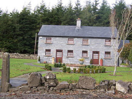 The HolliesWorker's house · 1055 yd
Explorer Tom The Hollies in Ballynagall would survive a zombie attack by simply standing still and letting them trip over the rustic…
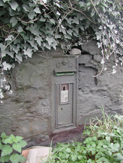 post box1242 yd
Explorer Tom Post box in Knockdrin is proud of its royal cipher, even though George V hasn’t been king for a very long time now.…
 Fairy fort / earthen ringfort in GarrysallaghFairy fort / earthen ringfort · 1640 yd
Explorer Tom Fairy fort / earthen ringfort in Garrysallagh is currently in a bitter dispute with the fairies over who gets to park…
 Fairy fort / earthen ringfort in Knockdrin (moyashel & Magheradernon By.)Fairy fort / earthen ringfort · 1.0 mi
Explorer Tom Fairy fort / earthen ringfort in Knockdrin has a family tree that is mostly invented because nobody can figure out…
 Church IslandIsland · 2.1 mi
Explorer Tom Church Island in County Westmeath would tell a teenager that the 1800s were basically just slow Wi-Fi and worse…
More historic places in County Westmeath · All of County Westmeath

What do you know about this place?Tap to add a comment or ask a question