DDiscover AloneMapAbout

Chapel in Dulane

Church

The monument record does not grant public access. Check the route and ask the landowner before entering private land.

What do you know about this place?Tap to add a comment or ask a question

What you write will be public.

What is recorded here

Situated on a rise in an undulating landscape. St. Cairnech was the son of Ceredic or Ceretic, a British chieftain, and Cairnech arrived in Ireland soon after St. Patrick. He is associated with the Senchas Mór, a code of Brehon law. He also contributed the Míosach, probably a Calendar, which became one of the battle…

Read the whole record
Situated on a rise in an undulating landscape. St. Cairnech was the son of Ceredic or Ceretic, a British chieftain, and Cairnech arrived in Ireland soon after St. Patrick. He is associated with the Senchas Mór, a code of Brehon law. He also contributed the Míosach, probably a Calendar, which became one of the battle fetishes of the northern Uí Neill and later the O’Donnells. Its shrine is now in the National Museum of Ireland. The saint’s feasday is on 16 May, and Dulane is one of the few churches dedicated to him, so he may have founded it (O’Connell 1958, 18-23; Ó Riain 2011, 145-6). The deaths of abbots are recorded from AD 743, and in 919 the daimhliag, or great stone church, of Tuiléan was burnt by the Vikings. It was plundered again in the great year of the raids, 949, and like nearly every church in Meath it was finally plundered by Diarmaid Mac Murrough in 1171 (Cogan 1862-70, 1, 133-4; O’Connell 1958, 23-5). The reference to a stone church in 919 is generally accepted as a terminus ante quem for the Dulane church (Ó Carragáin 2010, 113). By the 13th century the church at Dulane had become parochial and the church is attached to Kells in the ecclesiastical taxation (1302-06) of Pope Nicholas IV (Cal. doc. Ire. 5, lx). Ussher (1622) describes Duleene as a ruined chapel-of-ease to Kells (Erlington 1847-64, 1, xc). According to Dopping’s Visitation (1682 5) it was out of repair since the 1640s and the graveyard was not enclosed (Ellison 1973, 9). The remains of an early church consisting of the W (ext. dim. 8.13m) and S (L 14m; H 3m) walls survive, although the W wall is deeply buried and the S wall is not complete at the E end. There are antae (Wth 0.87m; L 0.73m) at the W end of the N and S walls and the outline of antae can be traced at the E end (total L of the S wall: 17.5m) of the undivided church. The trabeate doorway (Wth 1.03-1.08m; visible H 1.25m) in the W wall has a lightly incised roll moulding, and there are the vertical marks of arrow-sharpening on the impost. The large stones of the W wall can truly be described as cyclopean. There is an inserted pointed doorway (Wth 0.97m) in the S wall with a stoup inside it. The church is at the summit of the mound of a D-shaped graveyard (dims c. 60m E-W; c. 35m N-S) defined by an earth and stone bank (Wth 2.6-4.5m; int. H 0.2; ext. H 0.7m) SW-NW or a scarp (H 0.7-1m), but this obscures a wall which is visible at S (L c. 20m; H 0.3m). The graveyard was extended all round and defined anew with a masonry wall (max. dims c. 70m E-W; c. 40-65m N-S), although it may have truncated the old graveyard slightly on the N side. The headstones in the newly enclosed area date from c. 1900. Since then the graveyard has been extended to the N (dims c. 50-65m NNE-SSW; c. 60m WNW-ESE) where it is defined by cement walls. The sandstone base (basal dims 0.7m x 0.68m; H 0.67m) of a high cross with a roll moulding on the angle is in the graveyard N of the church, but a fragment of a high cross that may have belonged to it and was in the graveyard is now lost (Harbison 1992, 76). Man-made underground passage (ME011-035----) is outside the graveyard to the W. Around 1980 a cross-slab (max. dims 0.72m x 0.48m; T 0.1m) that was found in the graveyard was moved to the locked sacristy of the Roman Catholic church of the Sacred Heart at Mullaghey (ME017-053----), c. 1.25km to the SE, for safe-keeping. It has expanded square terminals, a ring and hollow angles. Over the cross is the inscription: ÓR DO ANAM CHAID. Archaeological testing (96E0118), N and S of the old graveyard identified fosses and pits in both areas (ME011-037001-; ME011-037002-) together with two fosses extending E-W that are N of the old graveyard and which are probably part of the N section of an ecclesiastical enclosure (ME011-037003-). (Meehan 1996; 1996a; 1997) The above description is derived from the published 'Archaeological Inventory of County Meath' (Dublin: Stationery Office, 1987). See attached view from NW (05); doorway showing arrow-marks (18) and general view of doorway from W (19) Compiled by: Michael Moore Date of revision: 9 April, 2019

From the National Monuments Service (Archaeological Survey of Ireland) record ME011-037

Places near here

Photo credits
  • National Inventory of Architectural Heritage
  • Miguel Angel Masegosa Martínez, Wikimedia Commons · CC BY 2.0
  • XNukes, Wikimedia Commons · CC BY-SA 4.0
  • Mark Duncan, Geograph · CC BY-SA 2.0
  • Nigel Thompson, Geograph · CC BY-SA 2.0
  • Stephen Keaveny, Wikimedia Commons · CC BY-SA 4.0
  • Maker named on the Wikimedia Commons picture page · CC BY-SA 3.0
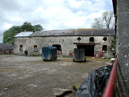
WilliamstownOutbuilding · 247 yd

Explorer Tom Williamstown in Williamstown seems to have wandered onto the wrong estate entirely by accident. The red brick is screaming at the slate roof for some reason. Pack a picnic and an excuse for trespassing nearby.

Sweet Chestnut884 yd

Explorer Tom Sweet Chestnut in County Meath would make Saint Patrick choke on his asparagus. It's too sweet for its own good, like a toddler with a lollipop. Stand still and listen, the wind tells it better than me.

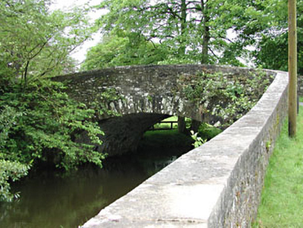
MountainpoleMountain / peak · 1.0 miMahonstown HouseGates/railings/walls · 1.2 miMahonstown BridgeBridge · 1.3 mi

Explorer Tom Mahonstown Bridge gave up its stone seat for Lent, but I suspect it still sneaks a rest there when no one’s looking. The long walls build up the suspense before you even reach the water. Stand there long enough and some magic happens.

DeerparkMountain / peak · 1.8 miSpire of LloydMonument · 1.8 miKells High Crosses and Round TowerMemorial · 1.8 miKells Round TowerMemorial · 1.8 miRound Tower1.8 mi

Explorer Tom The Round Tower in Town Parks nearly got sold for a horse back in the day. A king was murdered inside it, so the vibes are a bit intense. A proper spot for a flask of tea and a big think.

CastleCastle, unclassified · 1.8 mi

Explorer Tom The Castle at Town Parks might be haunted by a giant who lost his shoes and never got them back. It’s a legend that’s probably made up but sounds brilliant over pints. Dare you to say hello to it out loud.
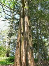
Dawn Redwood1.9 mi

Explorer Tom Dawn Redwood in County Meath has a bird that refuses to leave even when it’s snowing, which is frankly rude for everyone else. It looks like it fell out of a prehistoric movie set. Tell the next person you meet it's haunted. It might be.

More historic places in County Meath · All of County Meath

Add to this placeAdd a picture Add a detailed tip Add a story

Explore the map1,093,392 places to discover

Next place · or swipeWilliamstown